While out hunting for Ordnance Survey Bench Marks I am always on the lookout for anything connected with local history. The more unusual the better …
Today I found a thing’ More accurately I didn’t find a thing I found where a thing used to be. The site of the majestically and immpressively named Audley Destructor. Sadly, all that once was is now a modern housing estate.
The Audley Destructor was a renowned Victorian waste incinerator and was a significant landmark in Blackburn Lancashire. It was one of four waste incinerators constructed by the Blackburn Corporation. Standing at 312 feet and built from local Accrington brick, the chimney held the distinction of being the tallest in the UK upon its completion in 1888.
The Destructor continued to operate until 1959. In operation, each of four furnaces, or cells, could burn around 27 tons of waste per week which is a total of 108 tons.
The impressive chimney was finally demolished on 15 November 1959.
I have not yet been able to find any usable photographs.
The quarter peal rung on Friday, 29 August 2025 was my 700th quarter peal. I didn’t ask for a footnote as 220 of my quarter peal were rung via the Internet in Ringing Room. Ringing on a virtual platform always feels a little bit like cheating, I decided not to make a fuss about it.
Ringing Room, UK Friday, 29 August 2025 1,296 Cambridge Surprise Minor 1–2 Peter C Randall (C) 3 Barbara D Murray 4 Derek J Thomas 5 Nina E Brannan 6 Raymond A Hutchings £2.50 This performance was rung using simulated sound. Performed on a virtual ringing platform.. This performance is linked to the event Tuesday Peal Band Plus
Thursday, 10 October 2024 was a great night for viewing the Northern Lights from home. This was the second time this year they have been visible, but we managed to sleep through the first time. Visible for around 30 minutes, we had a decent view from both the front and back garden.
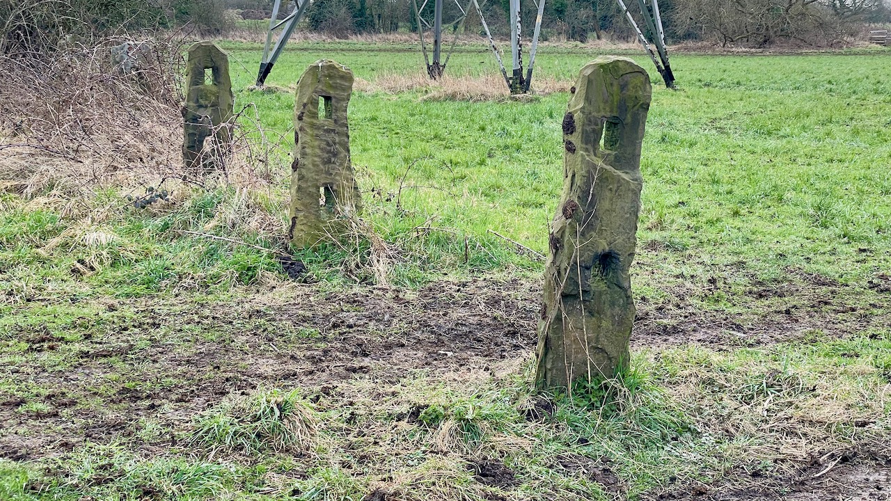
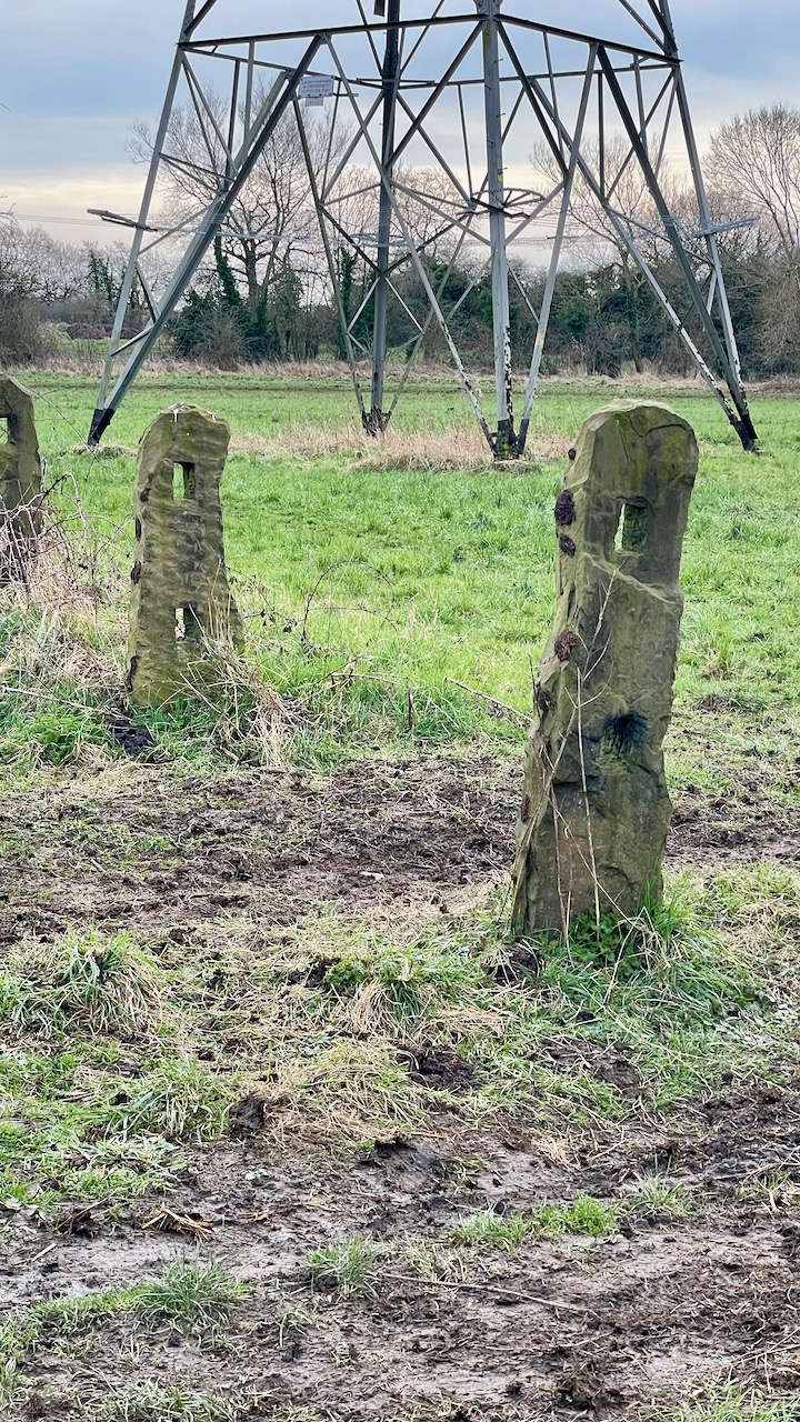
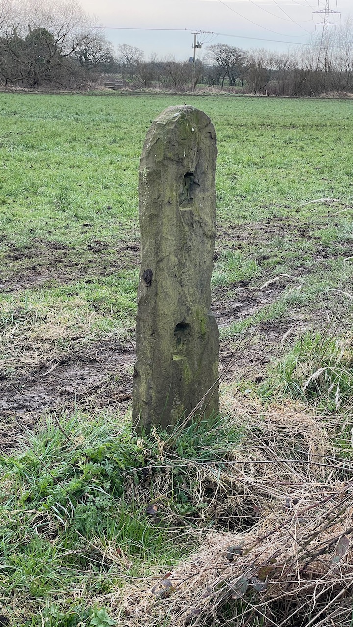
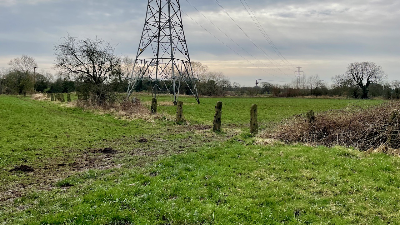
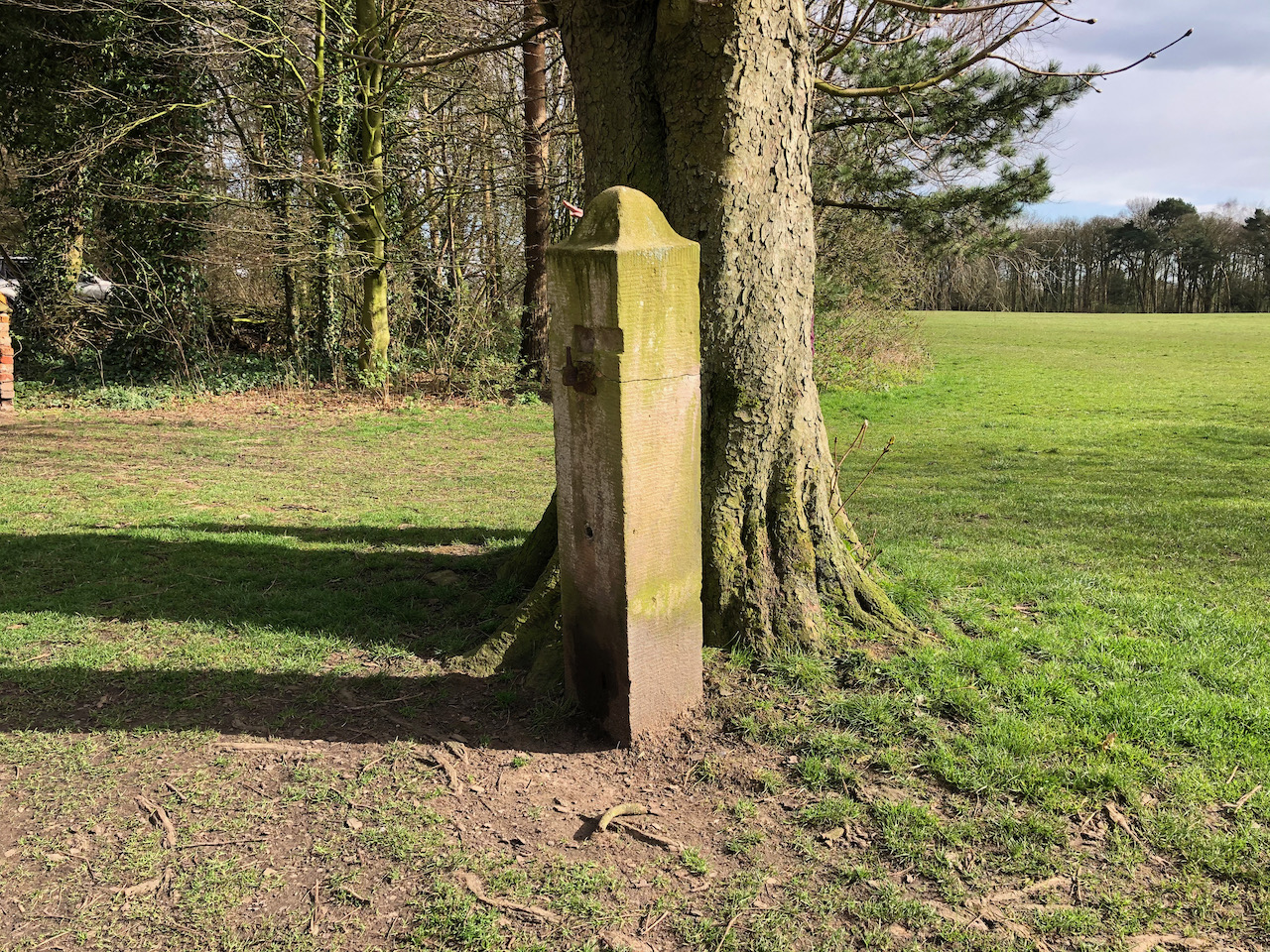
At Moss Side and to the west of Schleswig Way, the B5253, at OS grid reference SD 52327 21226 are the remains of 38 stone fence posts running north-west between The River Lostock and Wade Brook. They stand in the old water meadow known as Ambrye Meadow.
Thought to date back to around 1785 the sandstone posts were used to divide the meadow into three parcels of land.
The old fence posts in LeylandThe old fence posts in LeylandThe old fence posts in LeylandThe old fence posts in Leyland
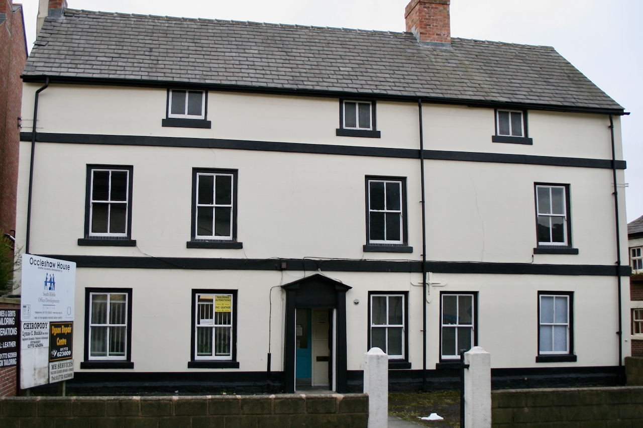
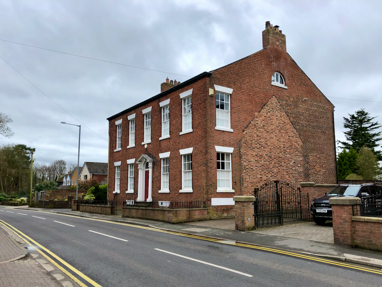
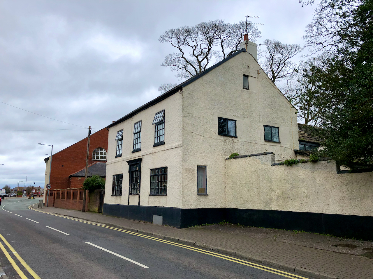
Worden Lane runs south from the top of Fox Lane towards Holt Brow passing Worden Park. Like many roads in Leyland it has had numerous names in the past: Whittaker Lane, then Lodge Lane, more recently New Road, and today – Worden Lane.
Leyland House, formerly St Mary’s Presbytery was built circa 1780.Clough House was built during the 18th Century.
Date Stones
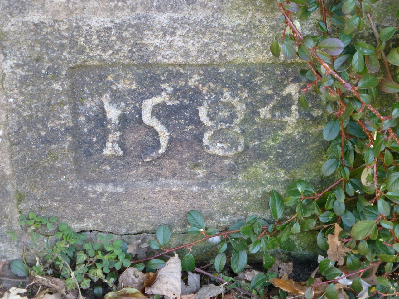
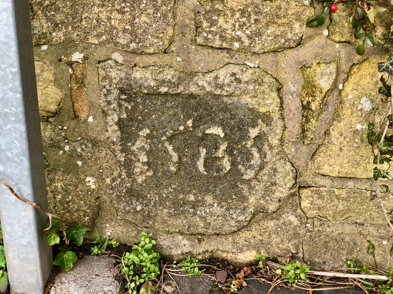
A pair of carved date stones in a wall beside Clough House on Worden Lane. One shows 1584 and the second shows 1585. They are not in their original locations as it is thought they came from St Andrew’s Church.
There are two such stones set into the wall of Clough House.
A carved date stone in the wall on Worden Lane with the date 1585.
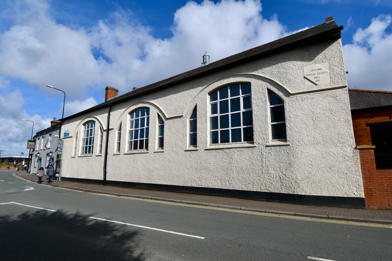
St Mary’s Roman Catholic Church
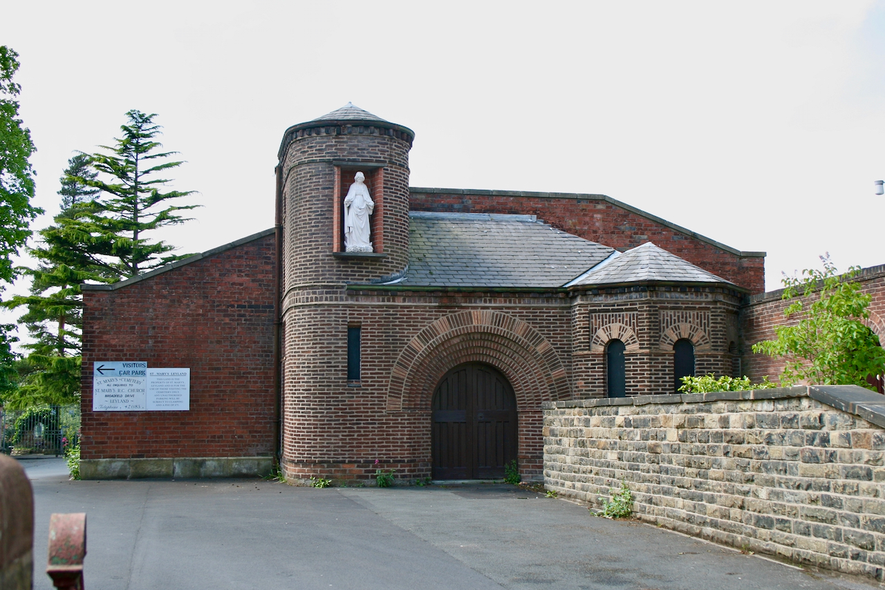
Established in 1854 by Rev. Henry Anselm Brewer, the Roman Catholic Church of St Mary’s replaced the earlier chapel of St Andrew the Apostle that had been opened in Leyland House. The church was enlarged in 1919 and was used until it closed in 1961 when the new St Mary’s church was built in Broadfield Drive. Only the front wall now remains. There is a graveyard behind which includes a war memorial.
S Mary’s Old Church
The Laurels
The Laurels was built in 1855 and significantly extended in 1936.
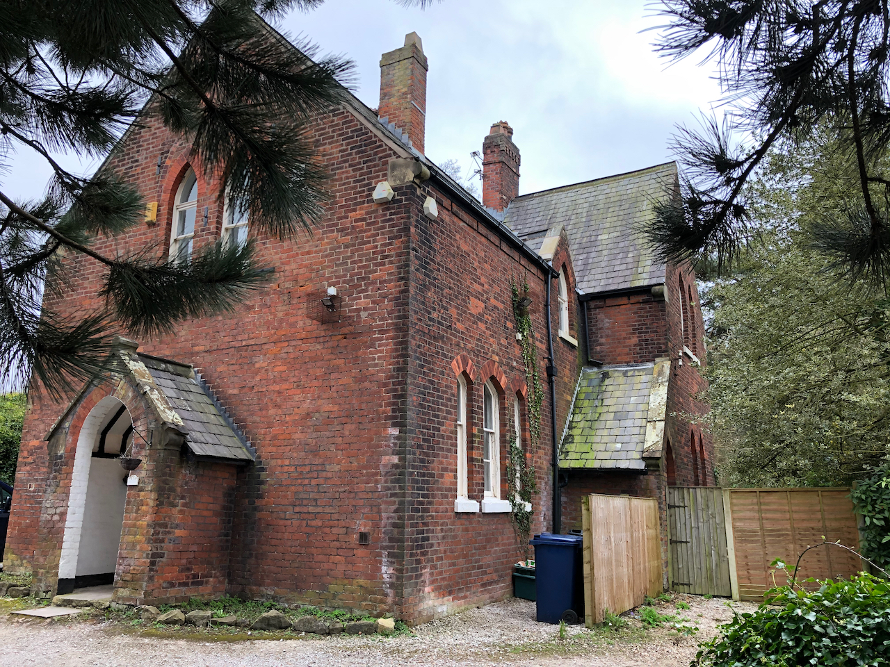
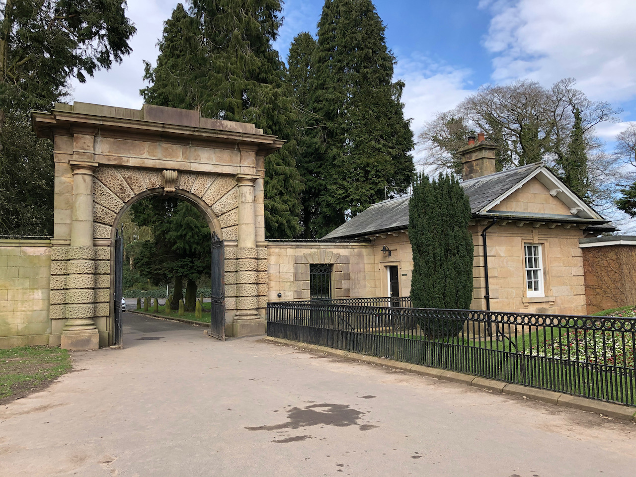
North Lodge
A very minor diversion from Worden Lane takes us to North Lodge and the entrance to Worden Park. The neoclassical North Lodge and gateway with its Tuscan style columns are still one of the main entrances to the parkland. The road that leads from it into the grounds is probably one of the original estate drives shown on the 1725 map. It forms a crossroads with another original drive ‘The Avenue’ which leads down towards the hall.
The neoclassical North Lodge and gateway with its Tuscan style columns.
Worden Park was acquired by the Farington in 1534. It remained in the possession of the family until their home, Worden Hall, was damaged in a fire in 1947. The lands and the ruined hall were sold, in 1950, to Leyland Urban District Council and the current park was opened to the public in 1951.
The hall has been demolished, but many of the early buildings and gardens can still be enjoyed today.
Our walk begins on the north side of the park at the 19th century gateway beside North Lodge heading south towards the junction with the former Hall Lane and the remains of Worden Hall.
The site was included in land granted to the Knights of St John of Jerusalem in the C12 or early C13. Worden subsequently passed from the Bussel family to the Anderton family. In 1534 it was acquired by Sir Henry Farington and it remained in the Farington family until 1947. In 1950 Leyland Council purchased it. It was opened to the public on 18 June 1951 and it remains in use as a public park (1999).
Off Worden Lane, the neoclassical North Lodge and gateway with its Tuscan style columns is the main pedestrian entrance to the parkland for many in the town. The road that leads from it into the grounds, heading south, is probably one of the original estate drives shown on the 1725 map. It forms a crossroads with another original drive ‘The Avenue’ which leads west towards the site of the hall.
The neoclassical North Lodge and gateway with its Tuscan style columns.
Worden Lodge
Worden Lodge came about around 1761 following an agreement between Captain Isaac Hamon and Sir William Farington. Captain Hamon rented the northwest corner of a close known as Great Low Field, which was part of the Shaw Hall demesne.
All that remains now, at the western end of thecae park, is a short section of standing wall, a gatepost, and some dressed stone blocks in the trees around the car park.
Little or nothing now remains of the lodge which once sat on the land at the bottom of what is now the car park.Little or nothing now remains of the lodge which once sat on the land at the bottom of what is now the car park.
Worden Hall
The only extant section of wall of Worden Hall.
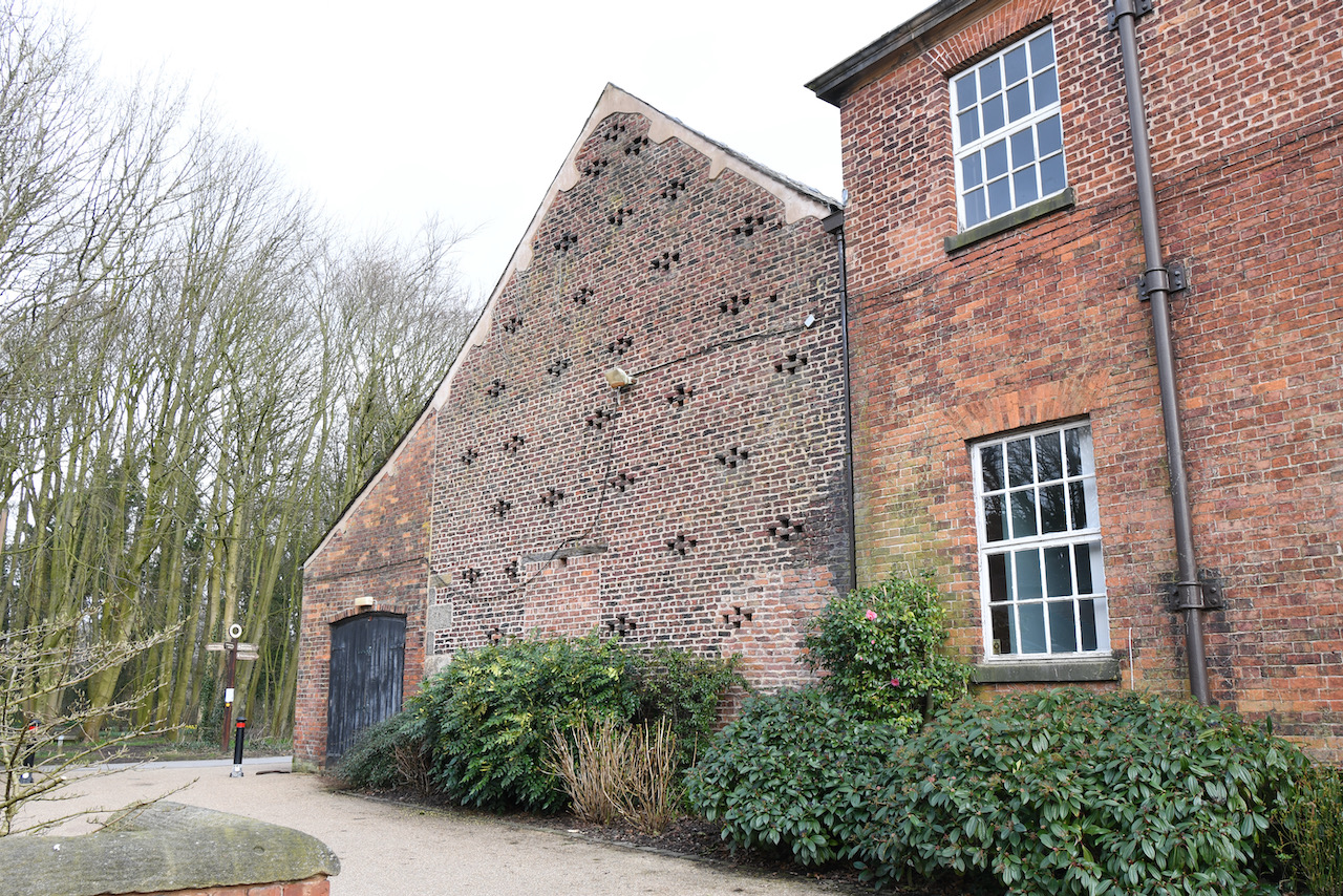
The Service Wing
The two-storied service wing was built of brick on a stone plinth.
The Brewhouse
The building used for brewing animal food rather than beer or ale.
The Stable Block
The stable block, tower, service wing and barn.
The Barn
An 18th century barn.
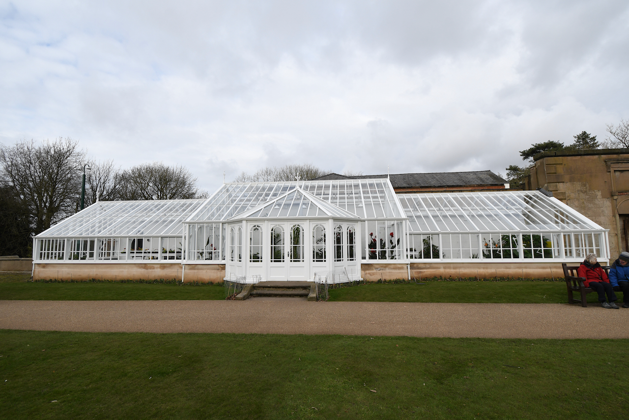
The Conservatory
Originally, possibly mid 19th century, a conservatory attached to Worden Hall, later used as a greenhouse, it is has a wooden frame on a stone plinth, and glazed walls and roof. A short section of the wall of Worden House remains standing to the right.
The recently restored, vandalised, and restored again conservatory.
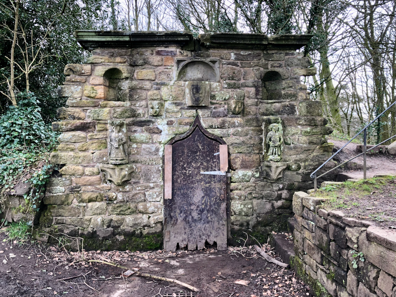
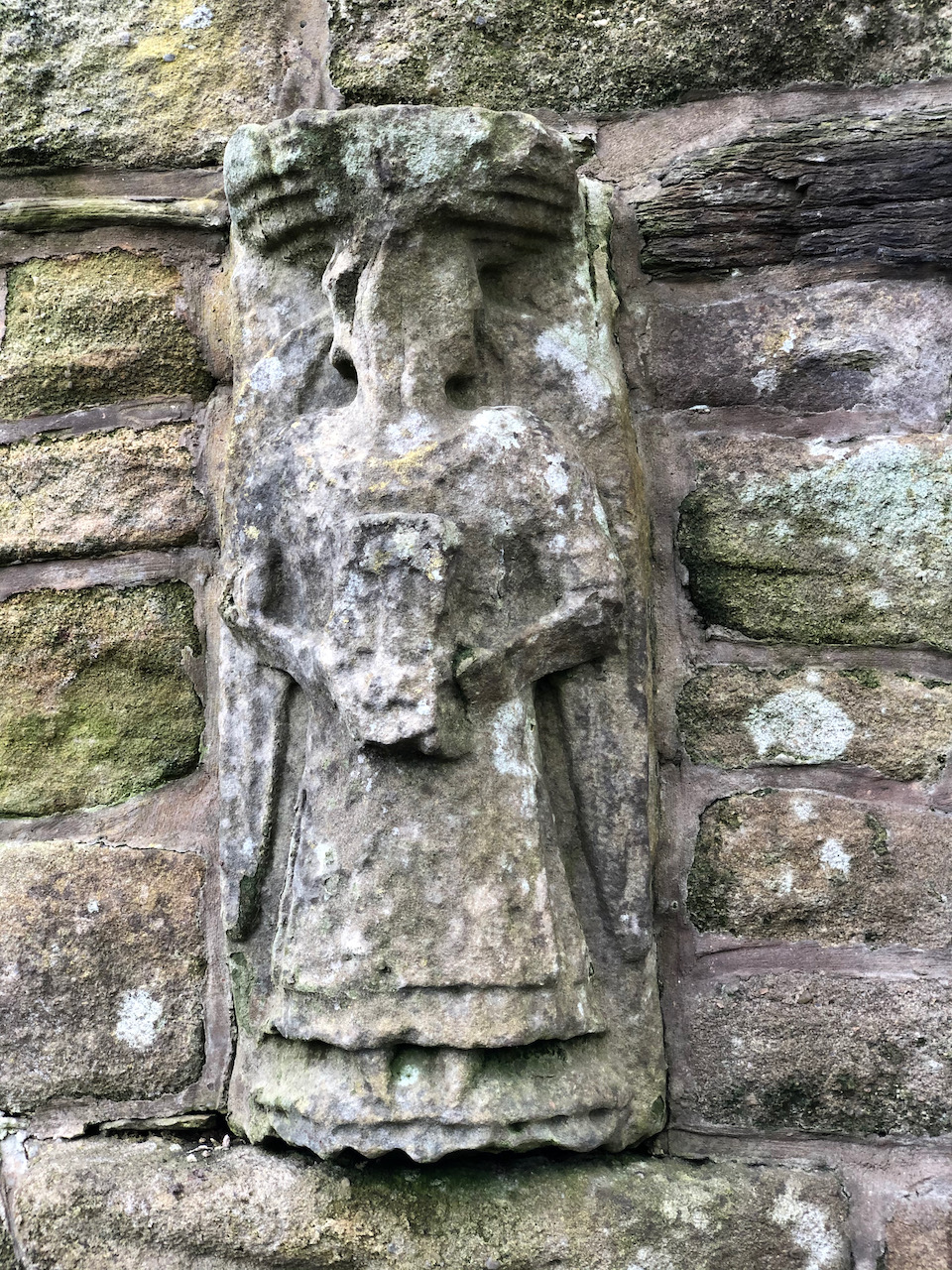
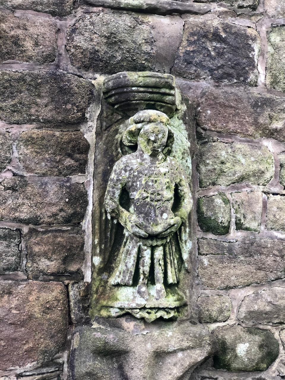
The Icehouse
The icehouse door, called an ogee, is S-shaped in section and is very unusual. Some of the ornamentation originates from the Parish Church and were relocated when the nave was altered in 1816. This includes two carved figures, either side of the door, which date to around 1500. They sit on two corbels that were clearly not designed to hold them. Other carvings include three shield shapes and a block with a hollow spandrel. There is no public access to the inside of the icehouse.
The icehouse door, called an ogee, is S-shaped in section and is very unusual. Some of the ornamentation originates from the Parish Church and were relocated when the nave was altered in 1816. This includes two carved figures, either side of the door, which dated to around the 1500s. They sit on two corbels that were clearly not designed to hold them. Other carvings include three shield shapes and a block with a hollow spandrel. There is no public access to the inside.Two carved figures, either side of the door, were moved here around 1816 when the parish church was extended. They date back to around the 1500s. They sit on two corbels that were clearly not designed to hold them.Two carved figures, either side of the door, were moved here around 1816 when the parish church was extended. They date back to around the 1500s. They sit on two corbels that were clearly not designed to hold them.
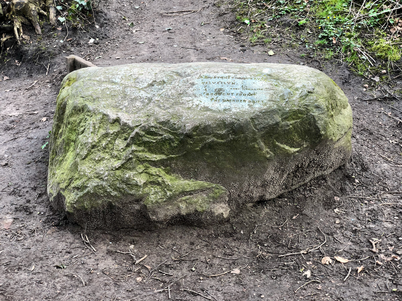
The Helvellyn Erratic
On the mound of the icehouse is a large inscribed rock with the inscription reading “Greenstone porphyry, Helvellyn, Prof I Phillips, brought from Worden drift”. This is a “glacial erratic”, and was brought from Helvellyn in the Lake District by a glacier during the last ice age.
On the mound of the icehouse is a large inscribed rock.
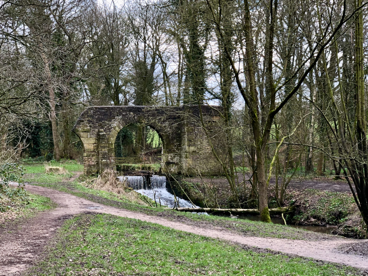
The Folly
The folly arch spanning Shaw Brook, with a small waterfall beneath.
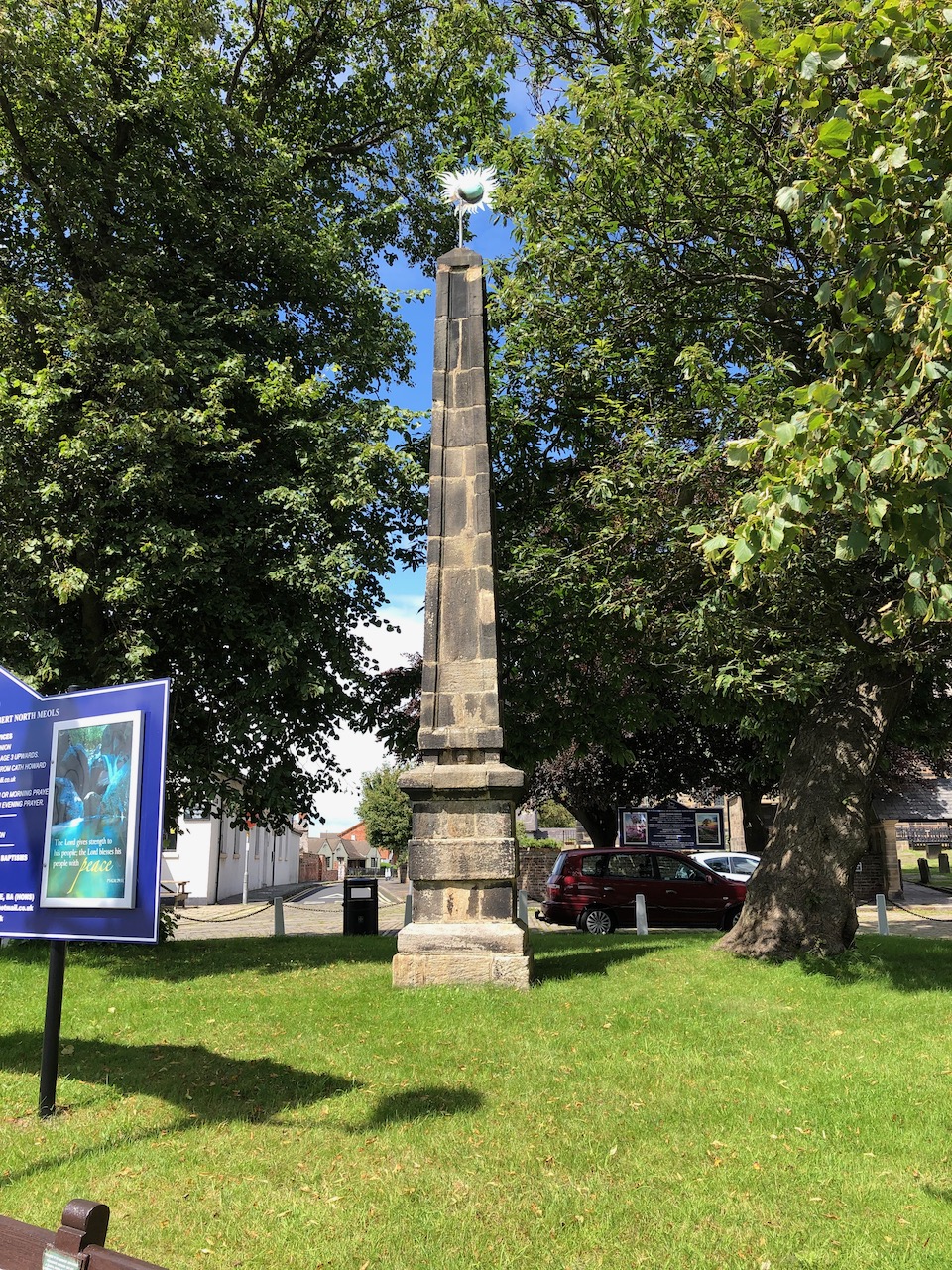
The Worden Obelisk
Now situated at Churchtown, Southport, Mersyside this 18 century commemorative obelisk was formerly at Worden Hall, Leyland. Following the fire at Worden Hall the obelisk was sold around 1948 to Colonel Roger Fleetwood Hesketh of Meols Hall and placed here in 1950. It is made from dressed gritstone blocks, of square section. The pedestal is c. 2m high, with a chamfered base, one broad band and a cavetto-moulded cornice with a worn inscription running round the east, north and west sides: Rebuilt in Commemoration of the Glorious illegible. More photographs can be seen in my blog.