While out hunting for Ordnance Survey Bench Marks I am always on the lookout for anything connected with local history. The more unusual the better …
Today I found a thing’ More accurately I didn’t find a thing I found where a thing used to be. The site of the majestically and immpressively named Audley Destructor. Sadly, all that once was is now a modern housing estate.
The Audley Destructor was a renowned Victorian waste incinerator and was a significant landmark in Blackburn Lancashire. It was one of four waste incinerators constructed by the Blackburn Corporation. Standing at 312 feet and built from local Accrington brick, the chimney held the distinction of being the tallest in the UK upon its completion in 1888.
The Destructor continued to operate until 1959. In operation, each of four furnaces, or cells, could burn around 27 tons of waste per week which is a total of 108 tons.
The impressive chimney was finally demolished on 15 November 1959.
I have not yet been able to find any usable photographs.
Thursday, 10 October 2024 was a great night for viewing the Northern Lights from home. This was the second time this year they have been visible, but we managed to sleep through the first time. Visible for around 30 minutes, we had a decent view from both the front and back garden.
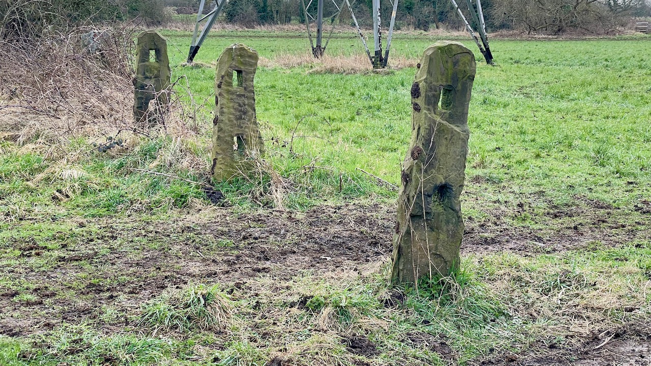
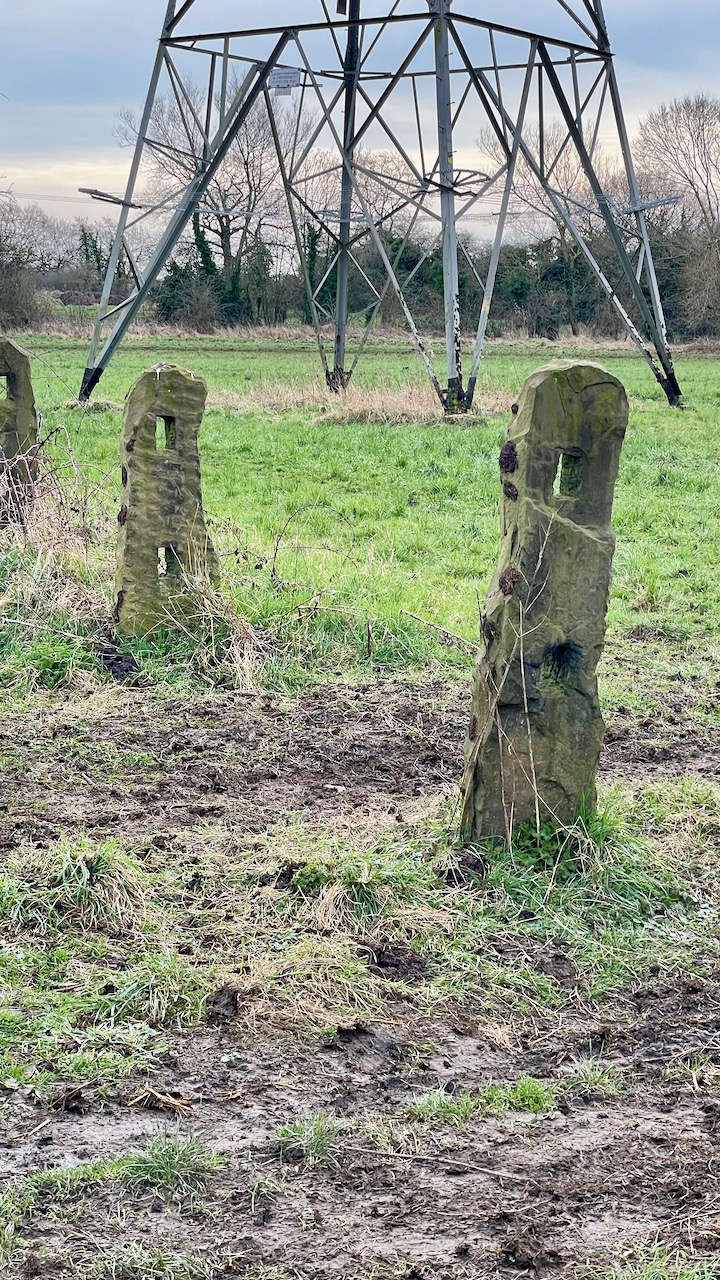
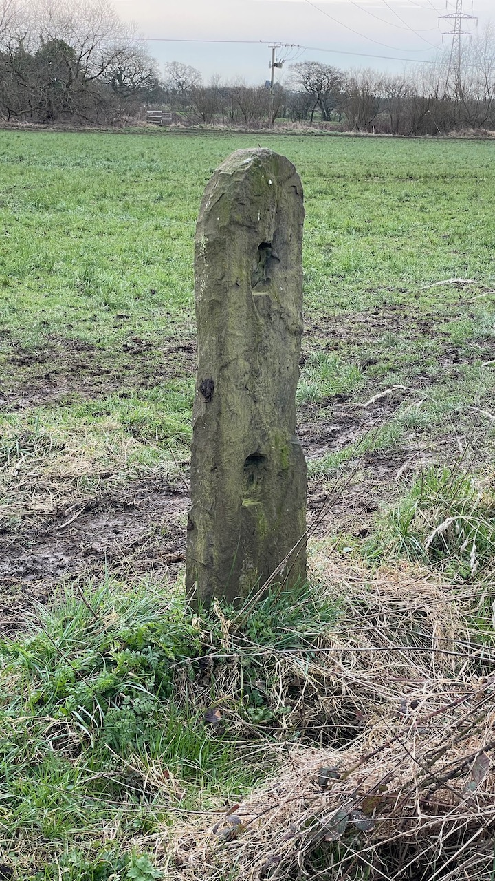
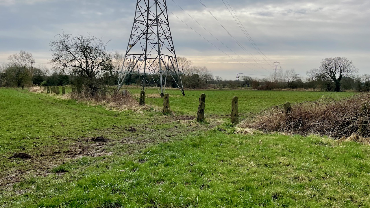
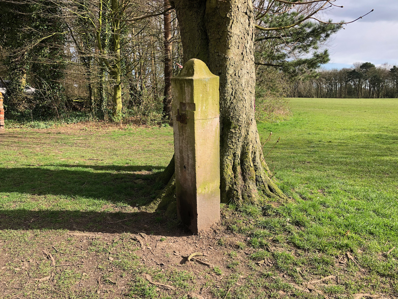
At Moss Side and to the west of Schleswig Way, the B5253, at OS grid reference SD 52327 21226 are the remains of 38 stone fence posts running north-west between The River Lostock and Wade Brook. They stand in the old water meadow known as Ambrye Meadow.
Thought to date back to around 1785 the sandstone posts were used to divide the meadow into three parcels of land.
The old fence posts in LeylandThe old fence posts in LeylandThe old fence posts in LeylandThe old fence posts in Leyland
Worden Lane runs south from the top of Fox Lane towards Holt Brow passing Worden Park. Like many roads in Leyland it has had numerous names in the past: Whittaker Lane, then Lodge Lane, more recently New Road, and today – Worden Lane.
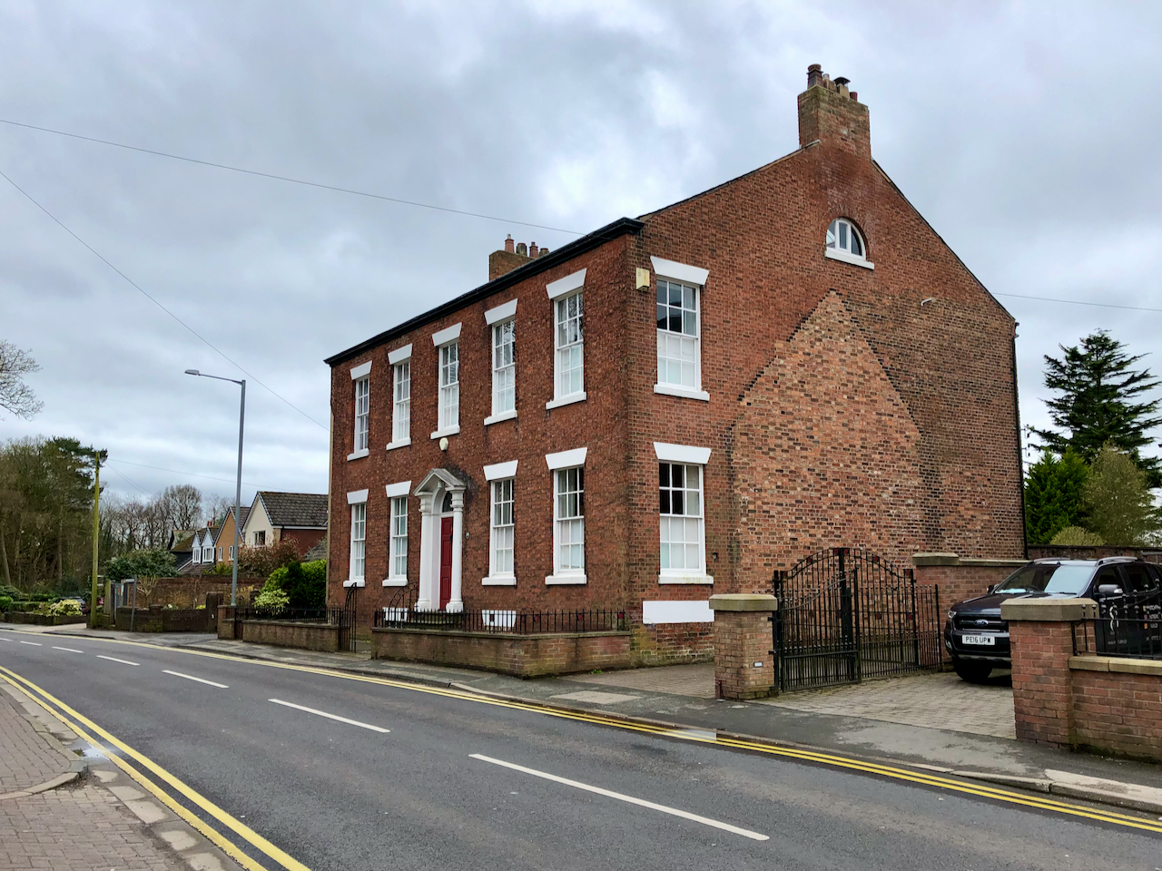
Leyland House, formerly St Mary’s Presbytery was built circa 1780.Clough House was built during the 18th Century.
Date Stones
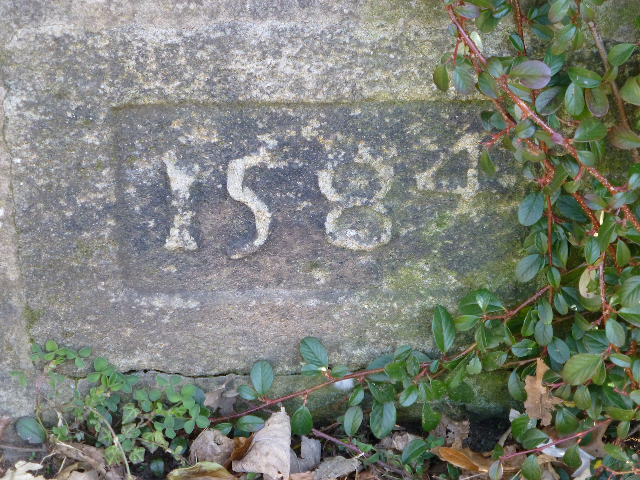
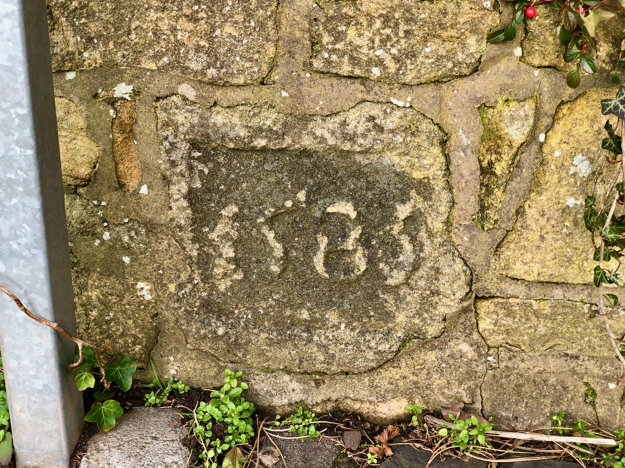
A pair of carved date stones in a wall beside Clough House on Worden Lane. One shows 1584 and the second shows 1585. They are not in their original locations as it is thought they came from St Andrew’s Church.
There are two such stones set into the wall of Clough House.
A carved date stone in the wall on Worden Lane with the date 1585.
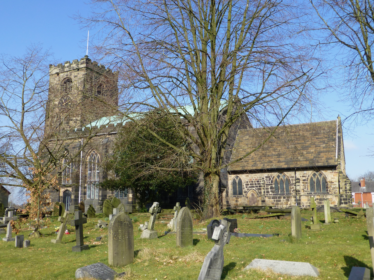
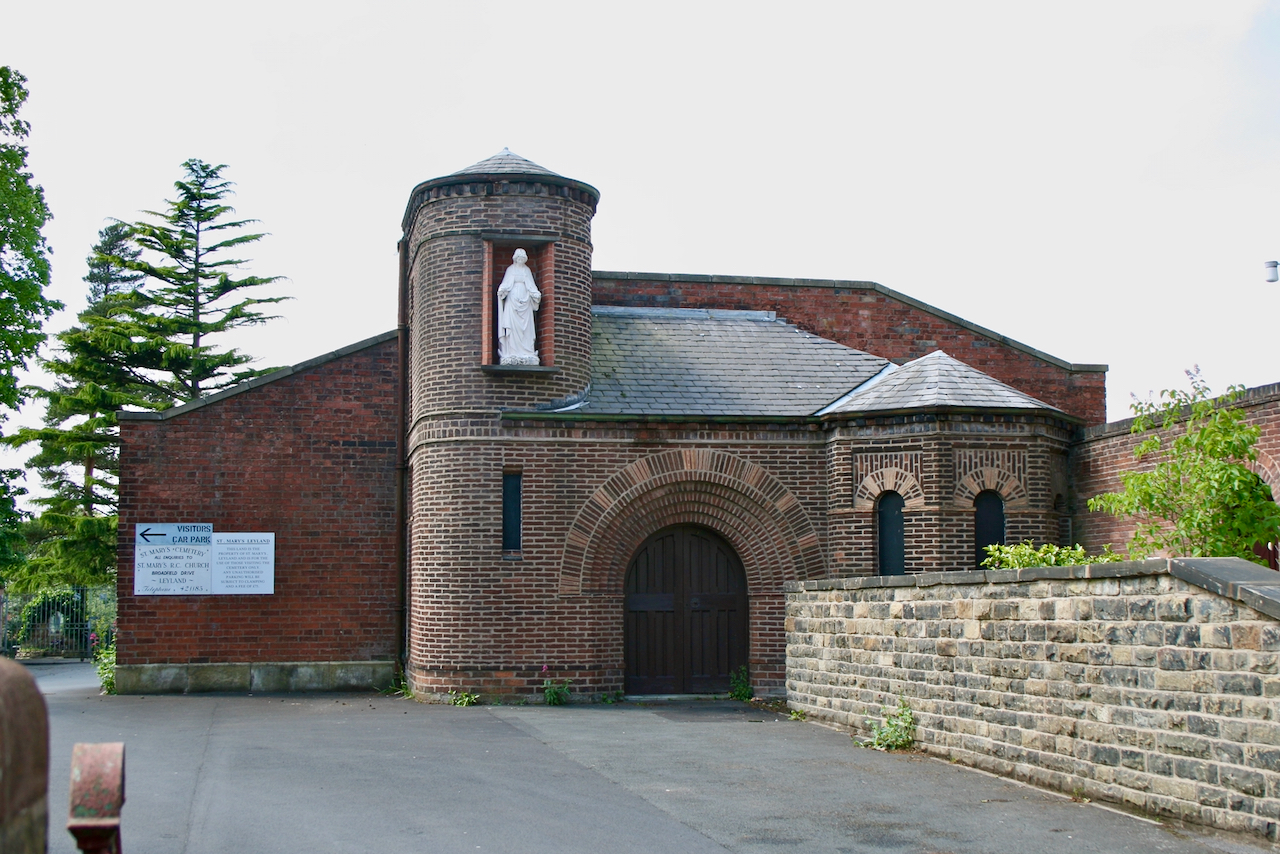
St Mary’s Roman Catholic Church
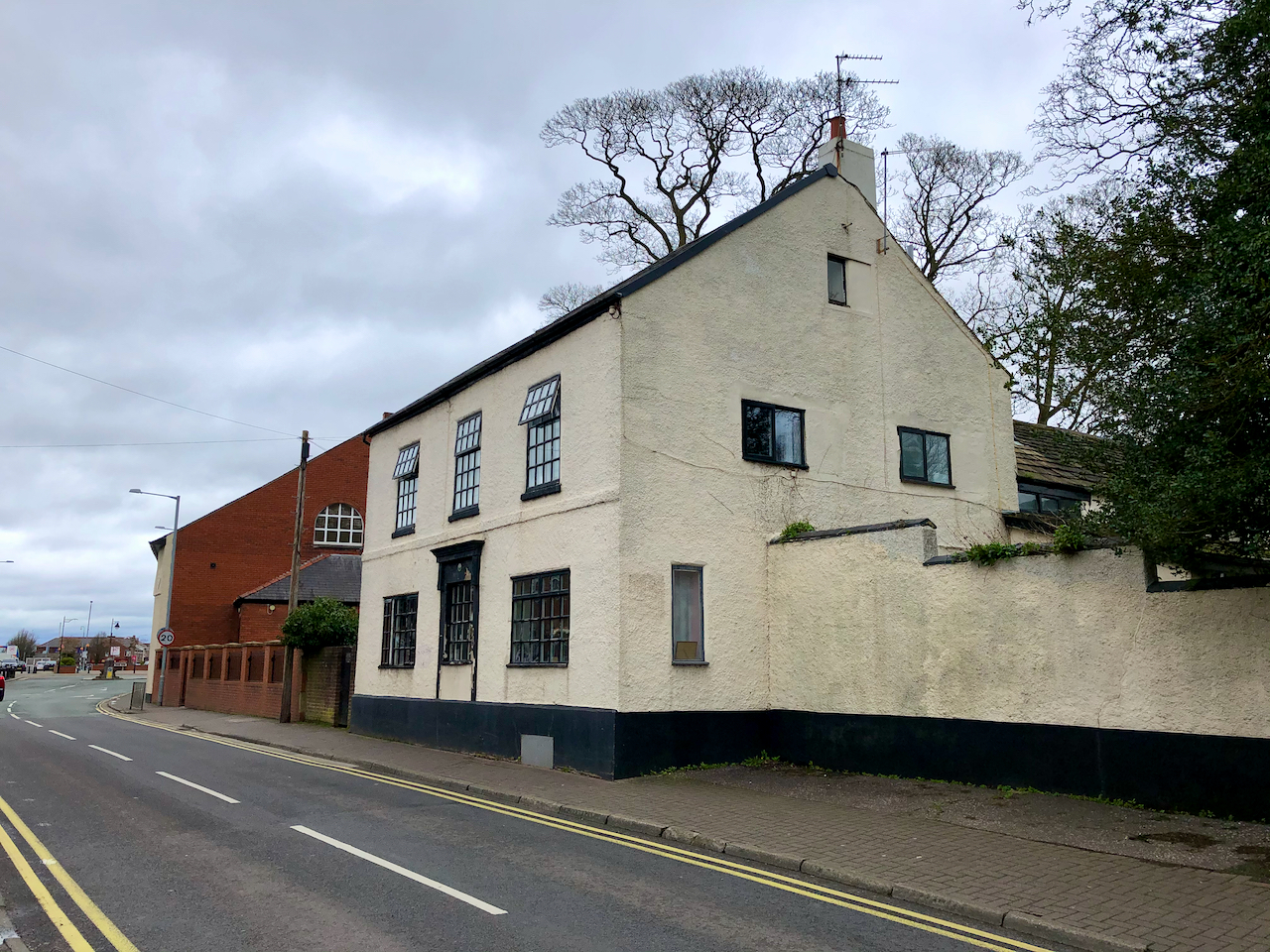
Established in 1854 by Rev. Henry Anselm Brewer, the Roman Catholic Church of St Mary’s replaced the earlier chapel of St Andrew the Apostle that had been opened in Leyland House. The church was enlarged in 1919 and was used until it closed in 1961 when the new St Mary’s church was built in Broadfield Drive. Only the front wall now remains. There is a graveyard behind which includes a war memorial.
S Mary’s Old Church
The Laurels
The Laurels was built in 1855 and significantly extended in 1936.
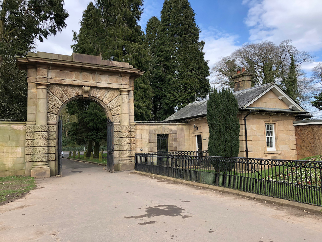
North Lodge
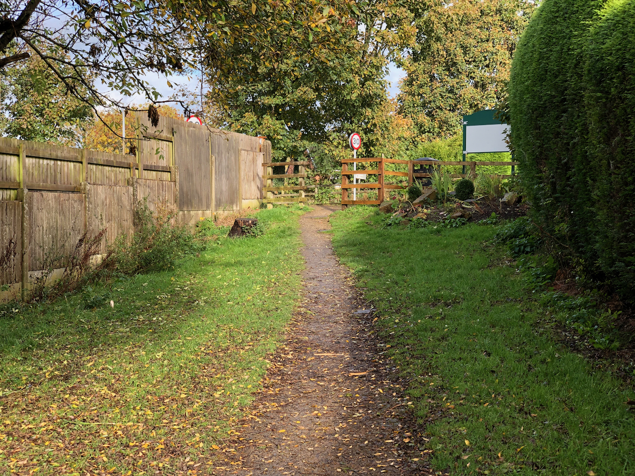
A very minor diversion from Worden Lane takes us to North Lodge and the entrance to Worden Park. The neoclassical North Lodge and gateway with its Tuscan style columns are still one of the main entrances to the parkland. The road that leads from it into the grounds is probably one of the original estate drives shown on the 1725 map. It forms a crossroads with another original drive ‘The Avenue’ which leads down towards the hall.
The neoclassical North Lodge and gateway with its Tuscan style columns.
Worden Park was acquired by the Farington in 1534. It remained in the possession of the family until their home, Worden Hall, was damaged in a fire in 1947. The lands and the ruined hall were sold, in 1950, to Leyland Urban District Council and the current park was opened to the public in 1951.
The hall has been demolished, but many of the early buildings and gardens can still be enjoyed today.
Our walk begins on the north side of the park at the 19th century gateway beside North Lodge heading south towards the junction with the former Hall Lane and the remains of Worden Hall.
The site was included in land granted to the Knights of St John of Jerusalem in the C12 or early C13. Worden subsequently passed from the Bussel family to the Anderton family. In 1534 it was acquired by Sir Henry Farington and it remained in the Farington family until 1947. In 1950 Leyland Council purchased it. It was opened to the public on 18 June 1951 and it remains in use as a public park (1999).
Off Worden Lane, the neoclassical North Lodge and gateway with its Tuscan style columns is the main pedestrian entrance to the parkland for many in the town. The road that leads from it into the grounds, heading south, is probably one of the original estate drives shown on the 1725 map. It forms a crossroads with another original drive ‘The Avenue’ which leads west towards the site of the hall.
The neoclassical North Lodge and gateway with its Tuscan style columns.
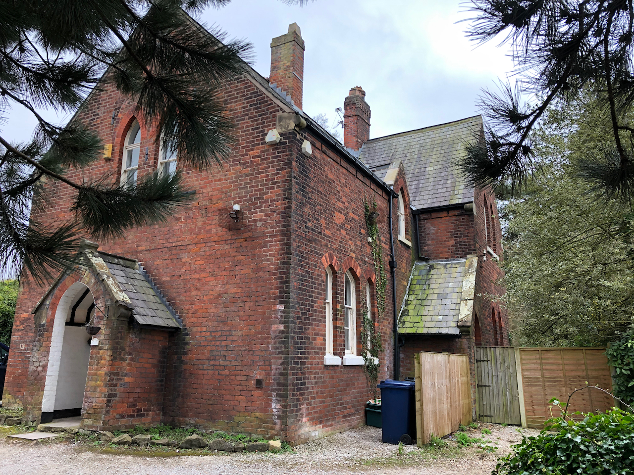
Worden Lodge
Worden Lodge came about around 1761 following an agreement between Captain Isaac Hamon and Sir William Farington. Captain Hamon rented the northwest corner of a close known as Great Low Field, which was part of the Shaw Hall demesne.
All that remains now, at the western end of thecae park, is a short section of standing wall, a gatepost, and some dressed stone blocks in the trees around the car park.
Little or nothing now remains of the lodge which once sat on the land at the bottom of what is now the car park.Little or nothing now remains of the lodge which once sat on the land at the bottom of what is now the car park.
Worden Hall
The only extant section of wall of Worden Hall.
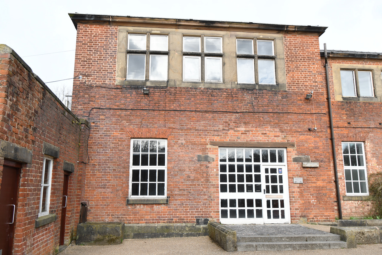
The Service Wing
The two-storied service wing was built of brick on a stone plinth.
The Brewhouse
The building used for brewing animal food rather than beer or ale.
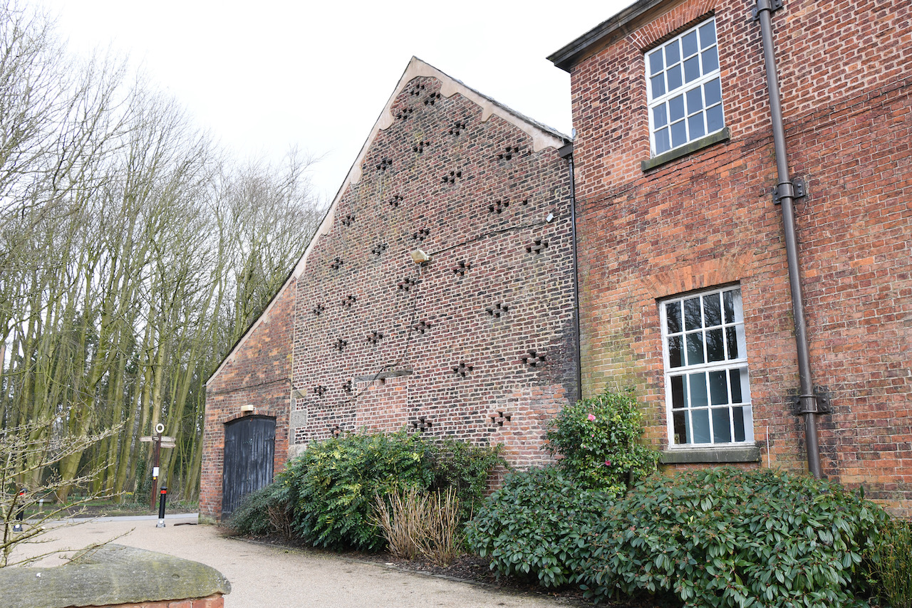
The Stable Block
The stable block, tower, service wing and barn.
The Barn
An 18th century barn.
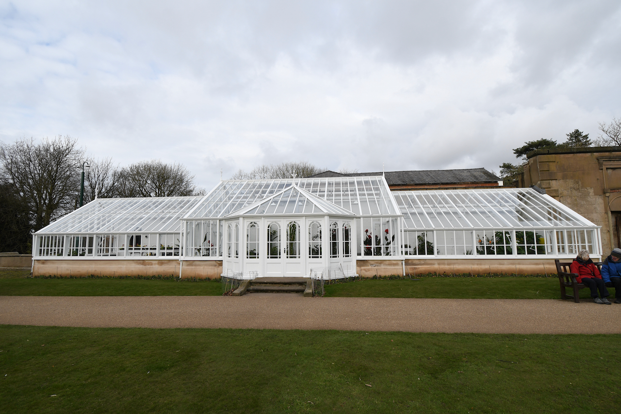
The Conservatory
Originally, possibly mid 19th century, a conservatory attached to Worden Hall, later used as a greenhouse, it is has a wooden frame on a stone plinth, and glazed walls and roof. A short section of the wall of Worden House remains standing to the right.
The recently restored, vandalised, and restored again conservatory.
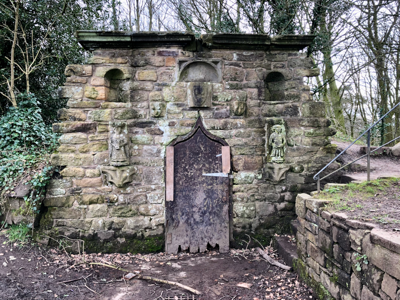
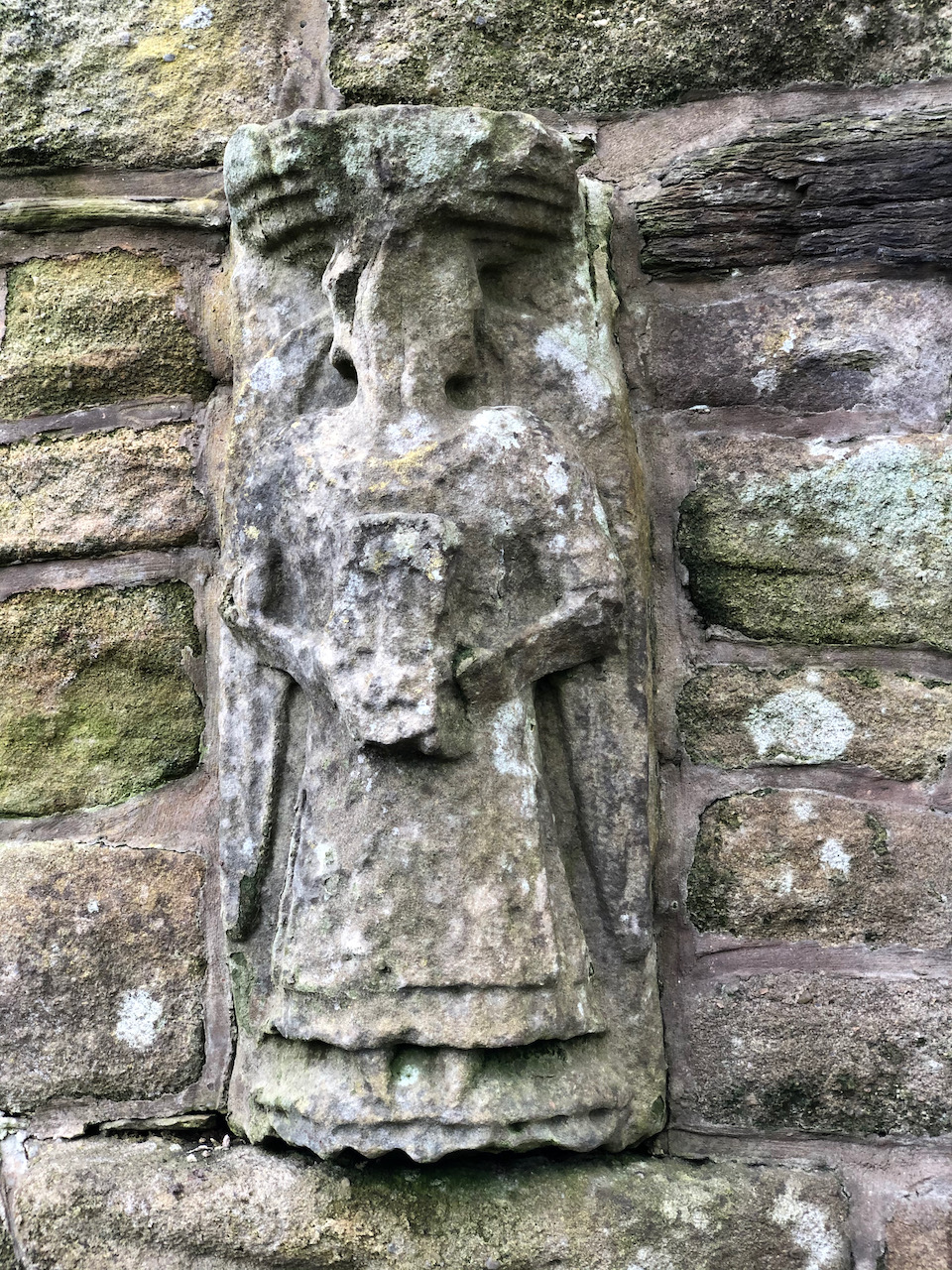
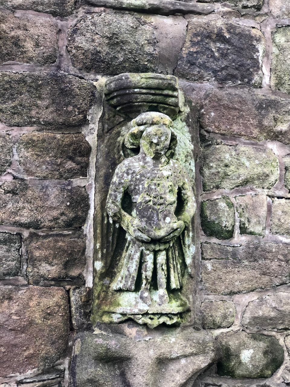
The Icehouse
The icehouse door, called an ogee, is S-shaped in section and is very unusual. Some of the ornamentation originates from the Parish Church and were relocated when the nave was altered in 1816. This includes two carved figures, either side of the door, which date to around 1500. They sit on two corbels that were clearly not designed to hold them. Other carvings include three shield shapes and a block with a hollow spandrel. There is no public access to the inside of the icehouse.
The icehouse door, called an ogee, is S-shaped in section and is very unusual. Some of the ornamentation originates from the Parish Church and were relocated when the nave was altered in 1816. This includes two carved figures, either side of the door, which dated to around the 1500s. They sit on two corbels that were clearly not designed to hold them. Other carvings include three shield shapes and a block with a hollow spandrel. There is no public access to the inside.Two carved figures, either side of the door, were moved here around 1816 when the parish church was extended. They date back to around the 1500s. They sit on two corbels that were clearly not designed to hold them.Two carved figures, either side of the door, were moved here around 1816 when the parish church was extended. They date back to around the 1500s. They sit on two corbels that were clearly not designed to hold them.
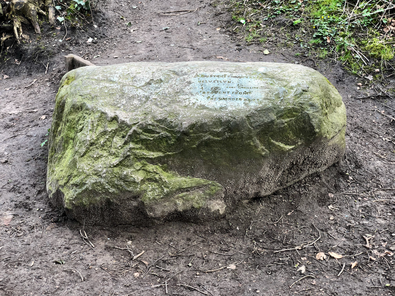
The Helvellyn Erratic
On the mound of the icehouse is a large inscribed rock with the inscription reading “Greenstone porphyry, Helvellyn, Prof I Phillips, brought from Worden drift”. This is a “glacial erratic”, and was brought from Helvellyn in the Lake District by a glacier during the last ice age.
On the mound of the icehouse is a large inscribed rock.
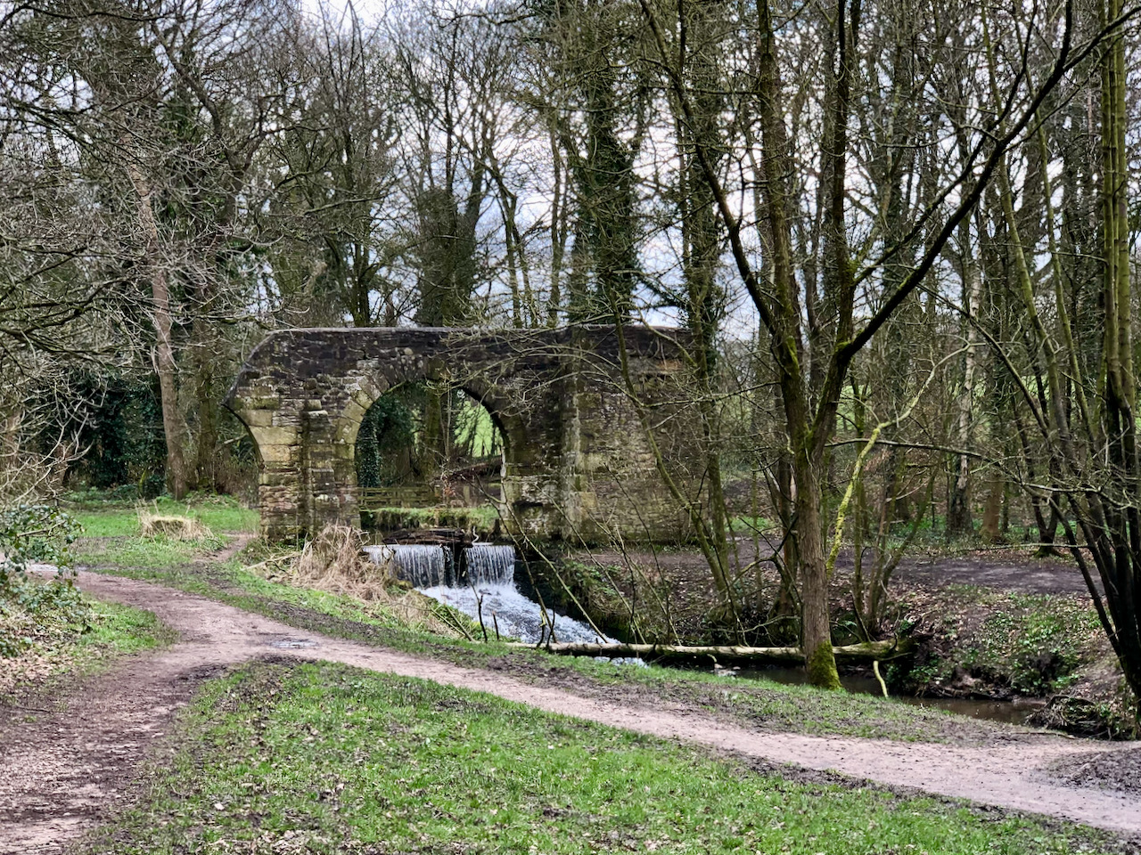
The Folly
The folly arch spanning Shaw Brook, with a small waterfall beneath.
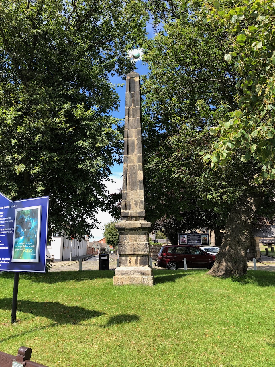
The Worden Obelisk
Now situated at Churchtown, Southport, Mersyside this 18 century commemorative obelisk was formerly at Worden Hall, Leyland. Following the fire at Worden Hall the obelisk was sold around 1948 to Colonel Roger Fleetwood Hesketh of Meols Hall and placed here in 1950. It is made from dressed gritstone blocks, of square section. The pedestal is c. 2m high, with a chamfered base, one broad band and a cavetto-moulded cornice with a worn inscription running round the east, north and west sides: Rebuilt in Commemoration of the Glorious illegible. More photographs can be seen in my blog.
Fox Lane is one of the early roads in Leyland and today it links Severn Stars with Towngate. On the 1844 Village Plan it is named Liverpool Road, but the 1830 and subsequent Ordnance Survey maps name it as Union Street. By 1890 the eastern end was known as Union Street as far west as the alms houses, the centre section was Fox Lane, and the western end around Seven Stars was named Brook Street.
All the older buildings are at either the eastern end, Union Street, or the western end, Brook Street. All the centre section is modern build.
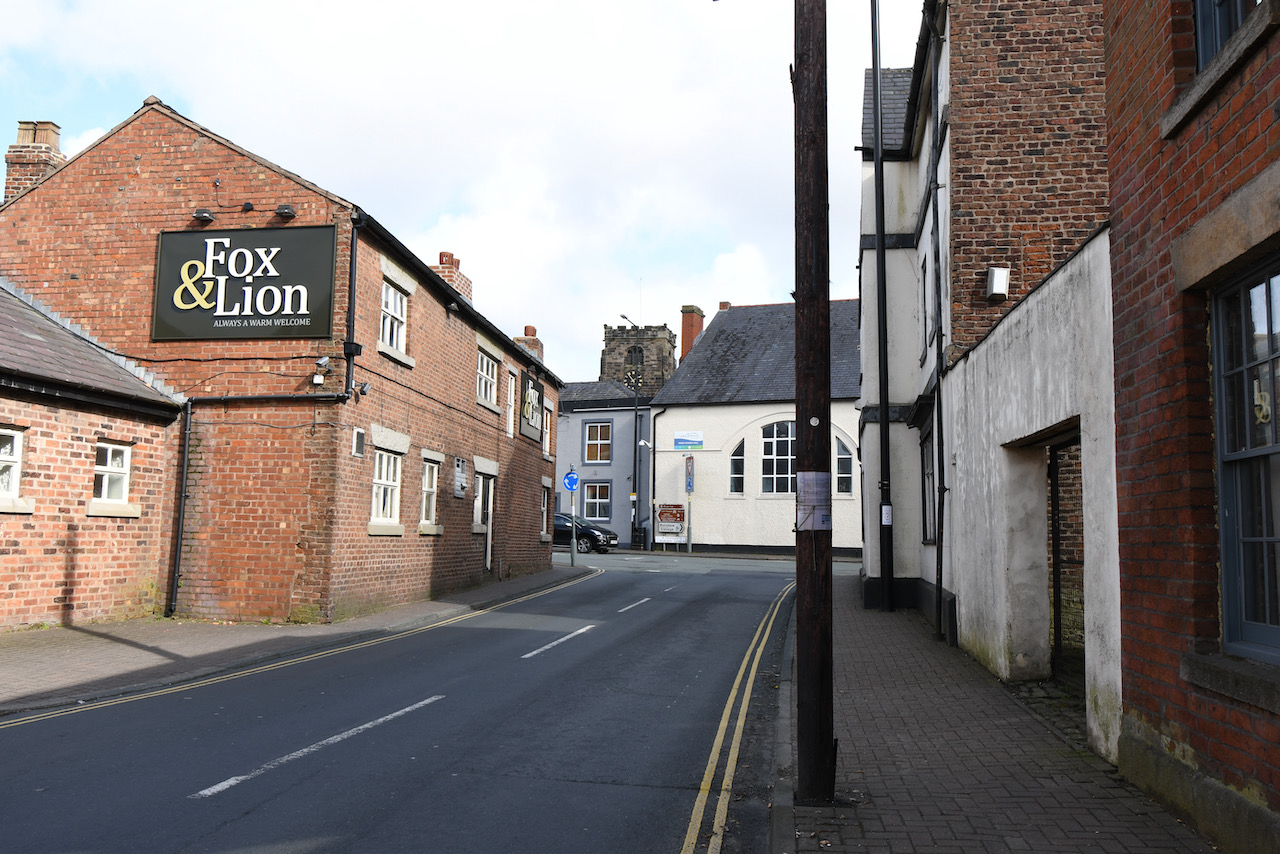
Our walk commences outside the Fox & Lion at the eastern end of Fox Lane.
The Fox & Lion
Looking east from the top of Fox Lane towards St Andrew’s Parish Church. The Fox & Lion was originally a row of cottages and was converted to a public house called The Ring O’ Bells. Sometime around the 1800s, the name was changed to Bay Horse. The Georgian look to the east front of building is fake.
The Fox & Lion Public House on Fox Lane, formerly Union Street.
Former Shops
Originally constructed as houses, these were converted to shops and are currently derelict. They have recently been sold …
Former shops on Fox Lane.
The Step Houses
A terrace of twenty-six brick-built cottages used by hand loom weavers. Originally known as the Friendly Society Houses, they are built around 1801.
A group of twenty-six cottages used by hand loom weavers. Originally known as the Friendly Society Houses, they are built around 1801.
The Former National School
Details to be added.
Rebuilt in 2016 this modern building was the site of the former National School or Top School. For many years only the front wall existed.
The cutting of the Lancaster Canal began around 1792 and since then the canal has always existed as two separate sections. The southern cutting ran from Bark Hill, in the south, to Walton Summit. The northern section ran from Preston Basin to Kendal.
For cost reasons the section between Walton Summit and Preston Basin, which required around 35 locks and an aqueduct to cross the Ribble Valley, was never completed. To enable to canal to operate a temporary tram road was opened in 1803 that enabled the transfer of cargo.
The Southern Cutting
Bark Hill to Johnson’s Hillock
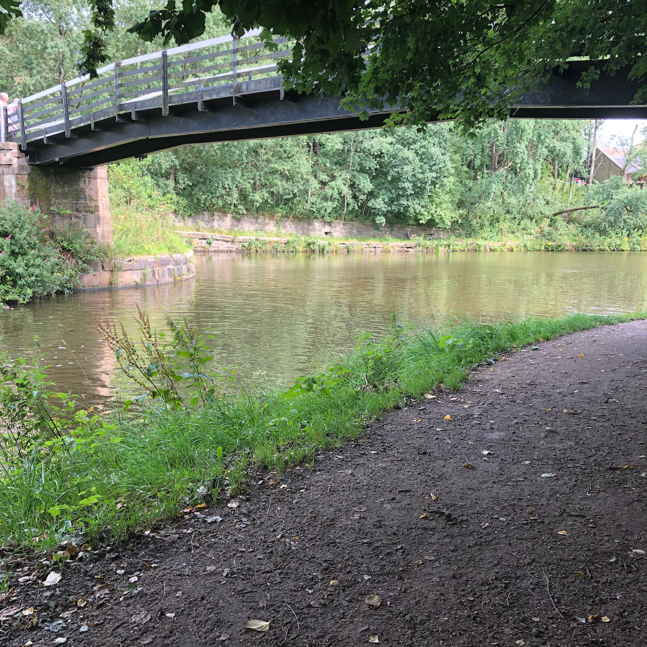
The southern cutting from Bark Hill, Aspull to Johnson’s Hillock, Whittle-le-Woods became part of the Leeds and Liverpool Canal in 1810 and is still navigable today. At Johnson’s Hillock there is a short arm of the original Lancaster Canal running north-west from the wooden lock bridge to Town Lane, Whittle-le-Woods.
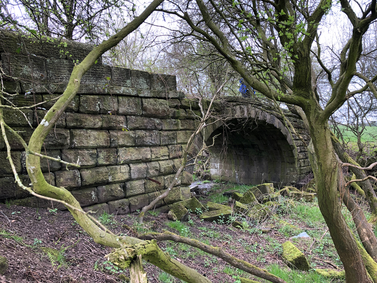
The wooden lock footbridge at Johnson’s Hillock. The cutting behind the bridge to the right of the photograph is now the Leeds & Liverpool Canal which continues to the left also behind the bridge towards Blackburn. The cutting to the left is the Lancaster Canal running up towards Walton Summit.The short cut of the Lancaster Canal from Johnson’s Hillock now ends where it reaches Town Lane.
Town Lane to Walton Summit
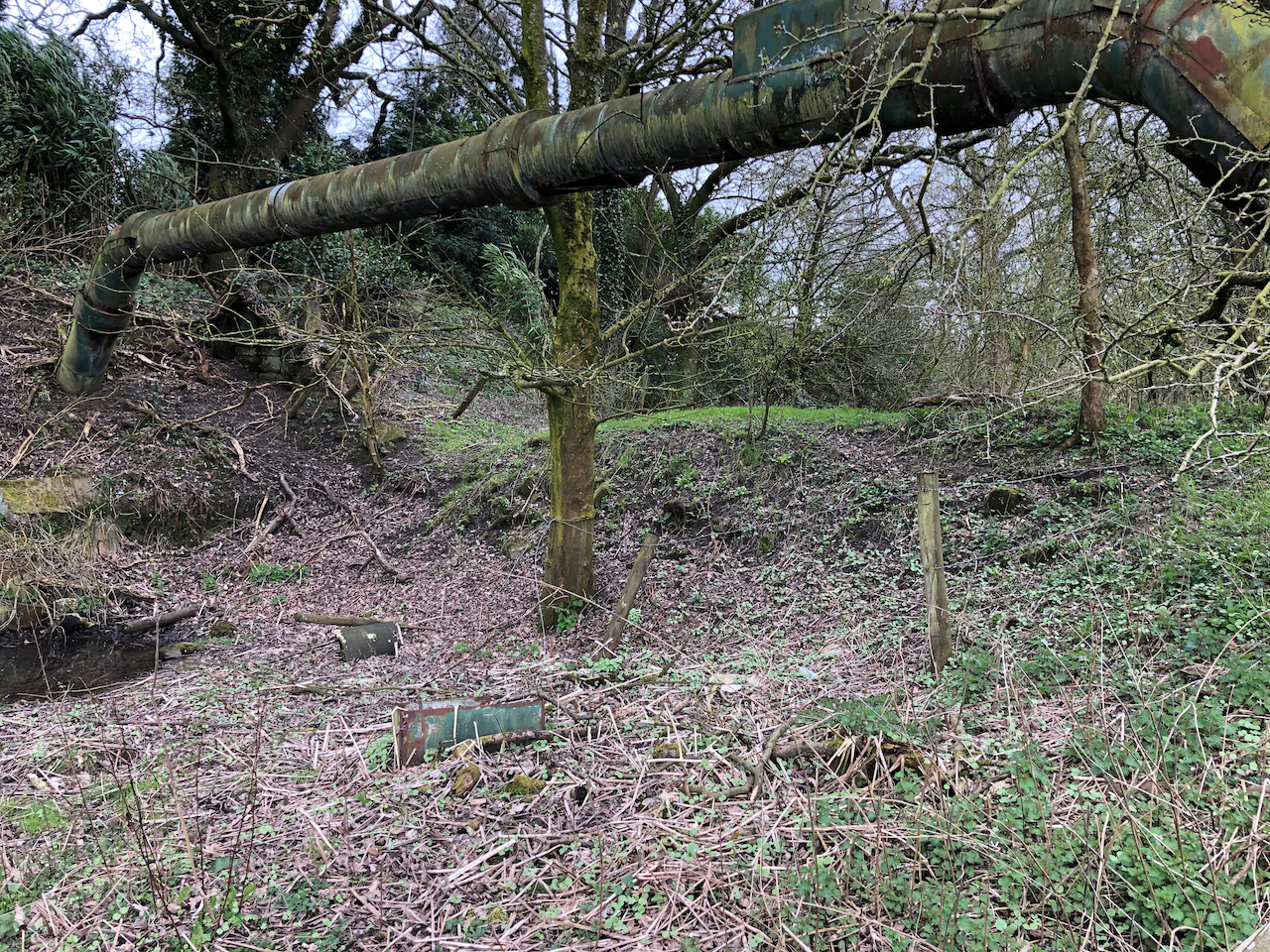
Almost all of the cut between Town Lane at Whittle-le-Woods and Walton Summit was filled by rubble from the construction of the M61 motorway. Through lack of use and the significant cost of constructing bridges and tunnels to accommodate the motorway, it was decided in the 1960s to close this section of the canal. Only a few very short sections of the cut are visible along with the remains of a few bridges and basins.
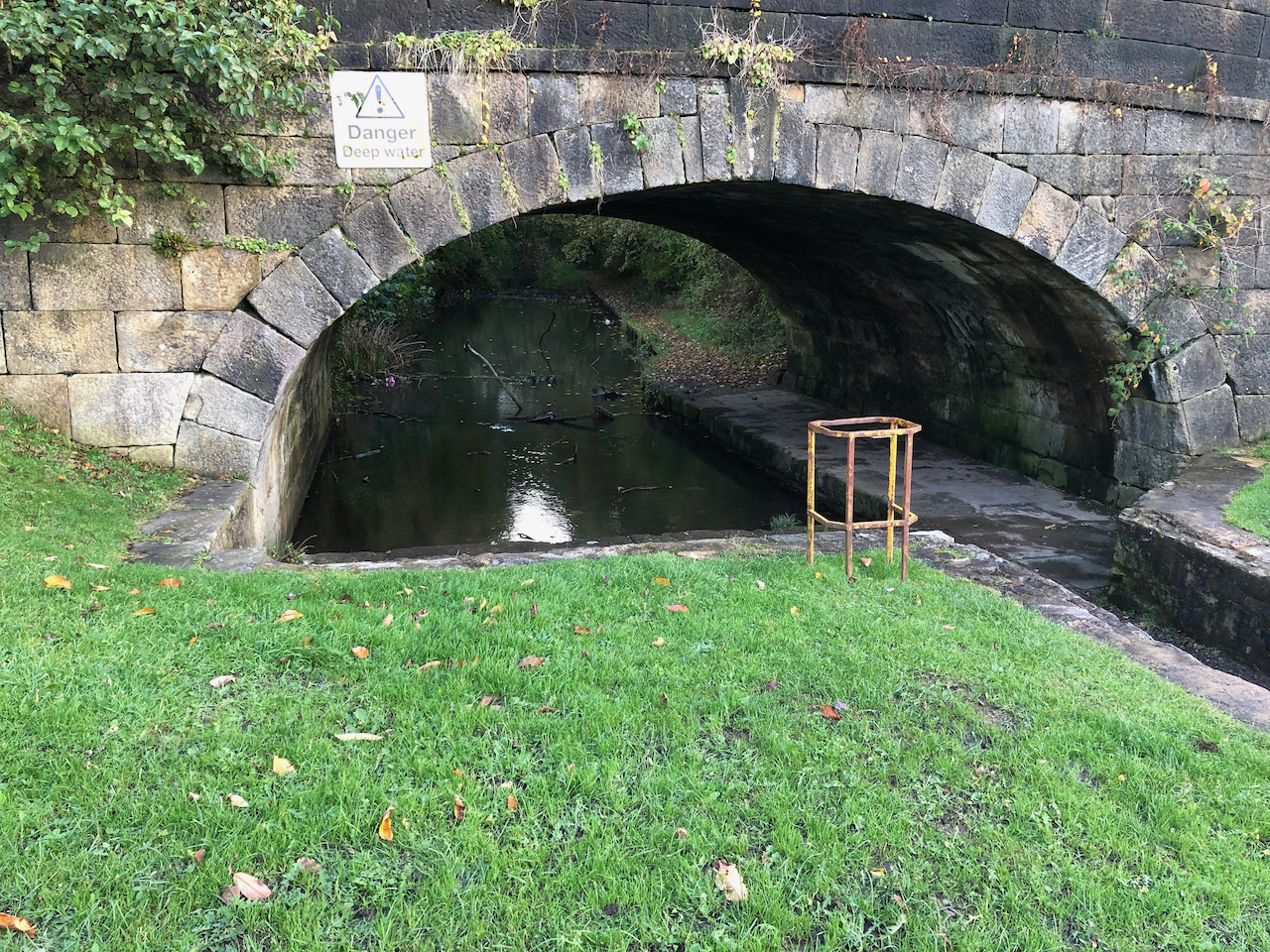
A short section of the two Whittle Tunnels can be found deep in a cutting outside Whittle-le-WoodsRemains of the canal and Moss Bridge at Whittle-le-Woods.
The two Whittle Tunnels and Moss Bridge can still be found in good condition at Whittle-le-Woods. Summit Bridge and White Bridge stand in isolation in woods close to Walton Summit and can be accessed by a footpath that runs under the M61 motorway.
Footpaths can now be walked that follow the line of the cutting as we head north from Whittle Tunnels.
Site of the former Dog Inn Bridge.Walking north along the course of the canal from Dog Inn BridgeSite of the former Radburn Canal Bridge
Following the former canal cutting as it passes between Brindle and Clayton Brook on its way to Walton Summit we come across the sites of White Bridge and Summit Bridge. White Bridge has been removed and replaced by a grass bank crossing the cutting. Summit Bridge stands isolated in woodland and crosses a muddy ditch.
The now filled in cut of the Lancaster Canal near to the site of White Bridge.The remains of White Bridge.The remains of Summit Bridge.
Walton Summit to Preston Basin
At Walton Summit the canal came to an abrupt stop. No simple solution of how to cross the river Ribble at Preston was known so as a temporary measure a tram road was laid allowing cargo to be hauled between Walton Summit and the basin in Corporation Street in Preston. The tram road crossed the river Ribble on a trestle bridge and was then winched up the steep bank in what is now Avenham Park. Bridges and tunnels then connected to Preston Basin.
The Tram Road
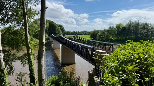
Signs of the tram road can still be found at Walton Summit, in Preston city centre, and near to Walton-le-Dale where the course of the tram road is used as a footpath. Until 2026 a large trestle bridge crossed the River Ribble in Avenham Park, but was unsafe so a modern bridge has been built to replace this. It has retained the name Tram Bridge.
Opened in 2026 Preston’s new Tram Bridge was built to replace the older bridge which was unsafe.
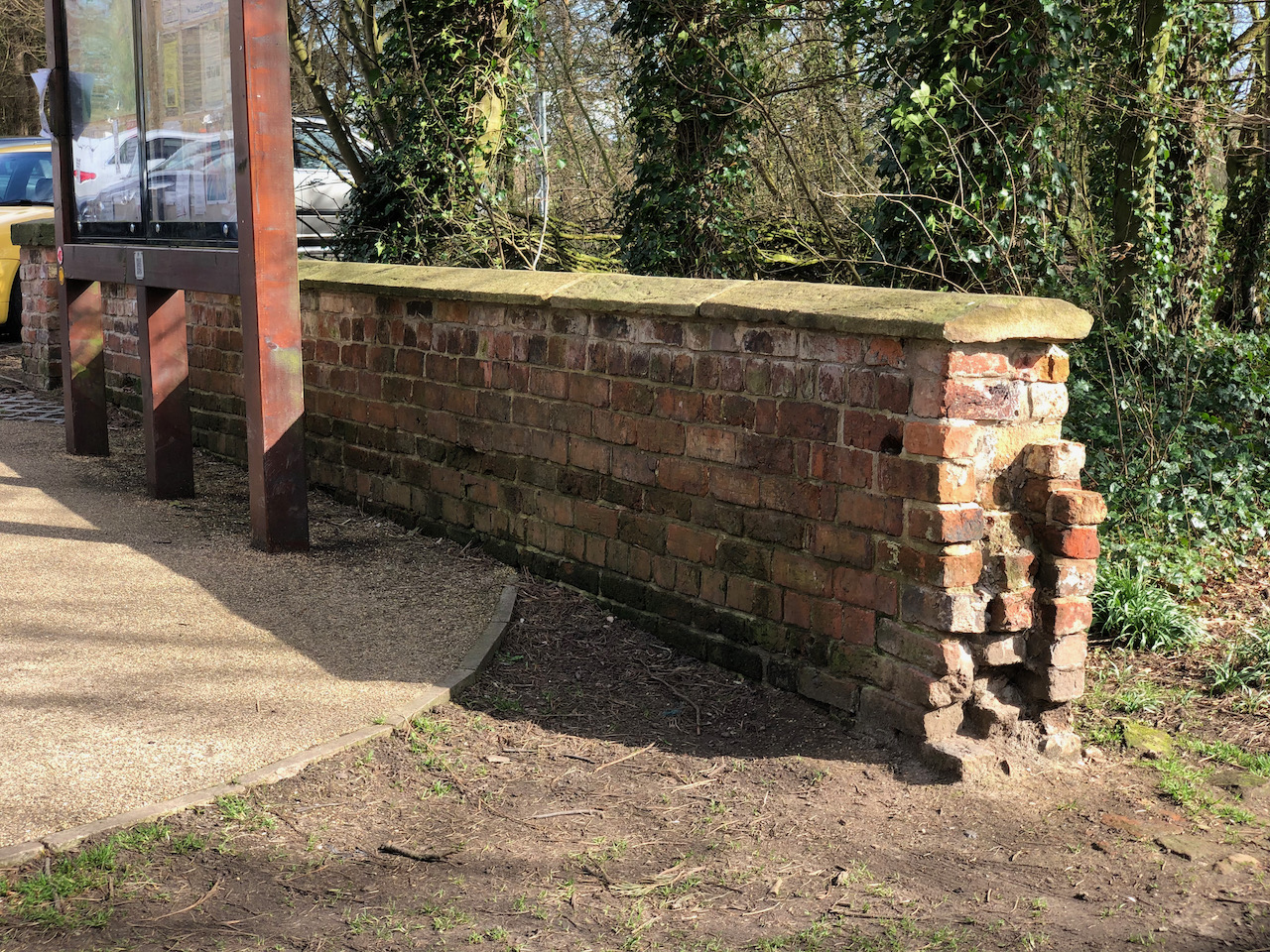
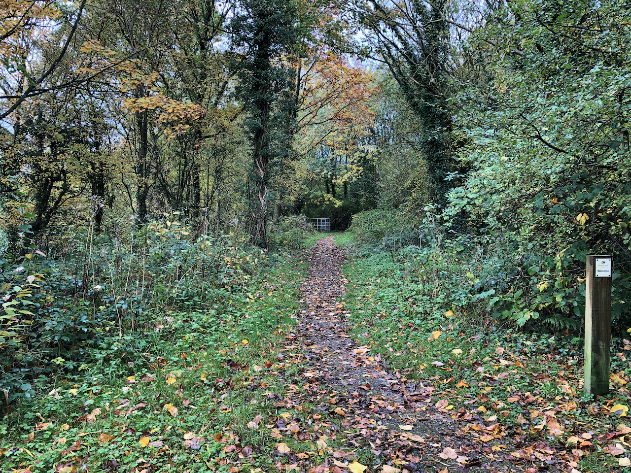
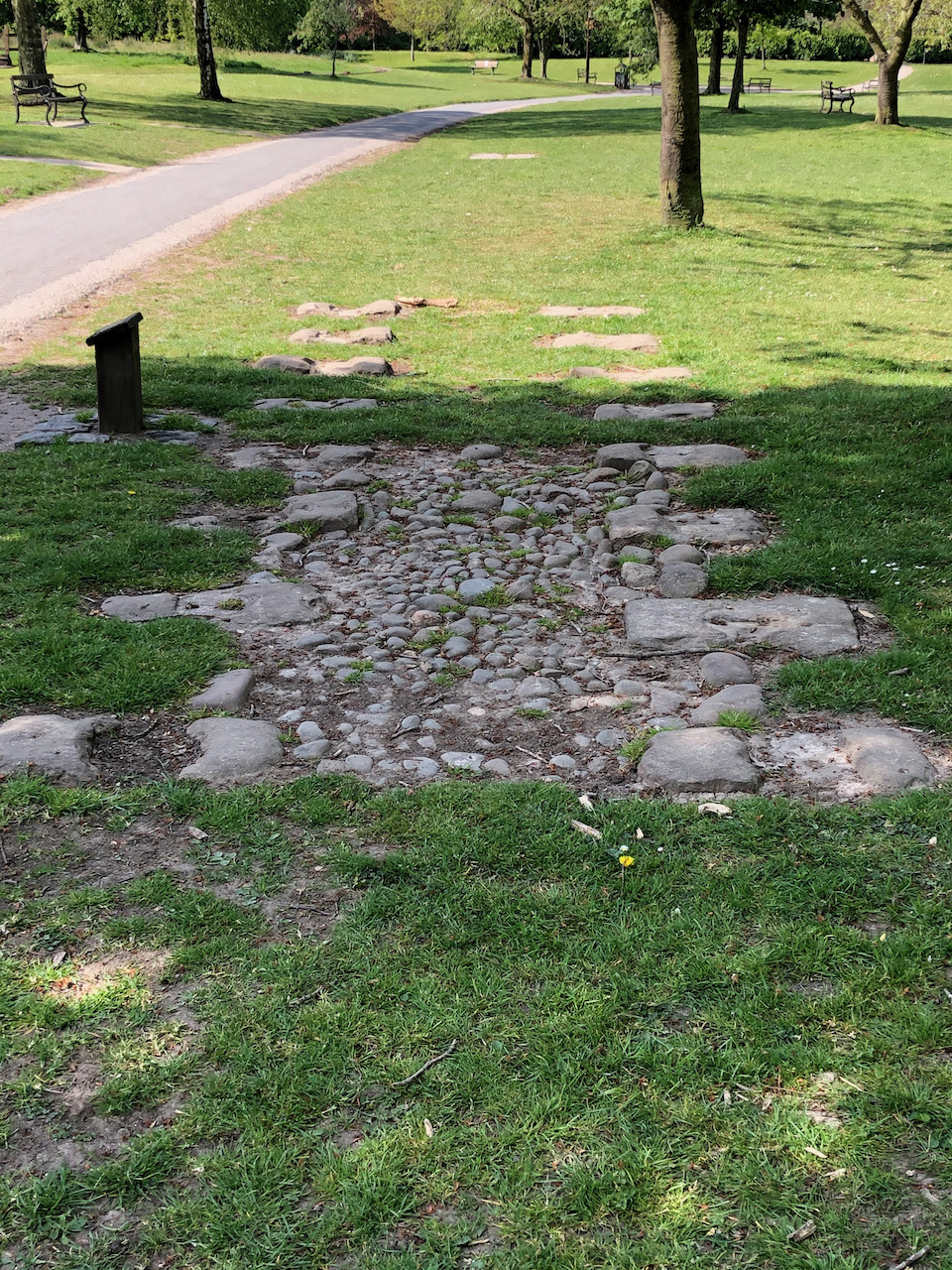
Two very small sections of the tram road were excavated in Bamber Bridge and have been preserved at Worden Park in Leyland.
This is a section of the old tramroad that was excavated at Station Road in Bamber Bridge.
The Northern Cutting
The basin at Preston was built on land to the north-east of Preston Central Station. The cut has now been filled as far as Preston Terminus at Maudlands which is about a mile to the north-west. The route of cut can still be followed on foot where some of the original buildings and bridges can still be seen. The basin site is currently occupied by the car park to the south of Abakhan and Poundstretcher.
The modern UCLAN student accommodation building is one of the warehouses that stood beside the basin near Corporation Street in Preston.
Preston Terminus is reached by steps from Aqueduct Street. So named by the aqueduct that once stood at the north end of Grove Street. The Lancaster Canal is watered from Preston Terminus.
The Lancaster Canal stops at Preston Terminus close to Aqueduct Street. The line of the cut, which has been filled, can still be followed on foot to the south-east where there is basin at Corporation Street.
Golden Hill Lane runs east to west from the end of Station Brow in the east to Leyland Lane in the west where it becomes Longmeanygate. For most of its length, it is designated as the B5256. Much of the development along Golden Hill Lane is modern.
Our walk starts at the east end of Golden Hill Lane starting on the short stretch of road, Golden Hill. Looking at the 1848 1:10,560 Ordnance Survey map Golden Hill may have been the route to the level crossing – it’s difficult to be certain. Somewhere between 1848 and 1894, the level crossing was replaced by the modern man-made hill, Station Brow, and the bridge.
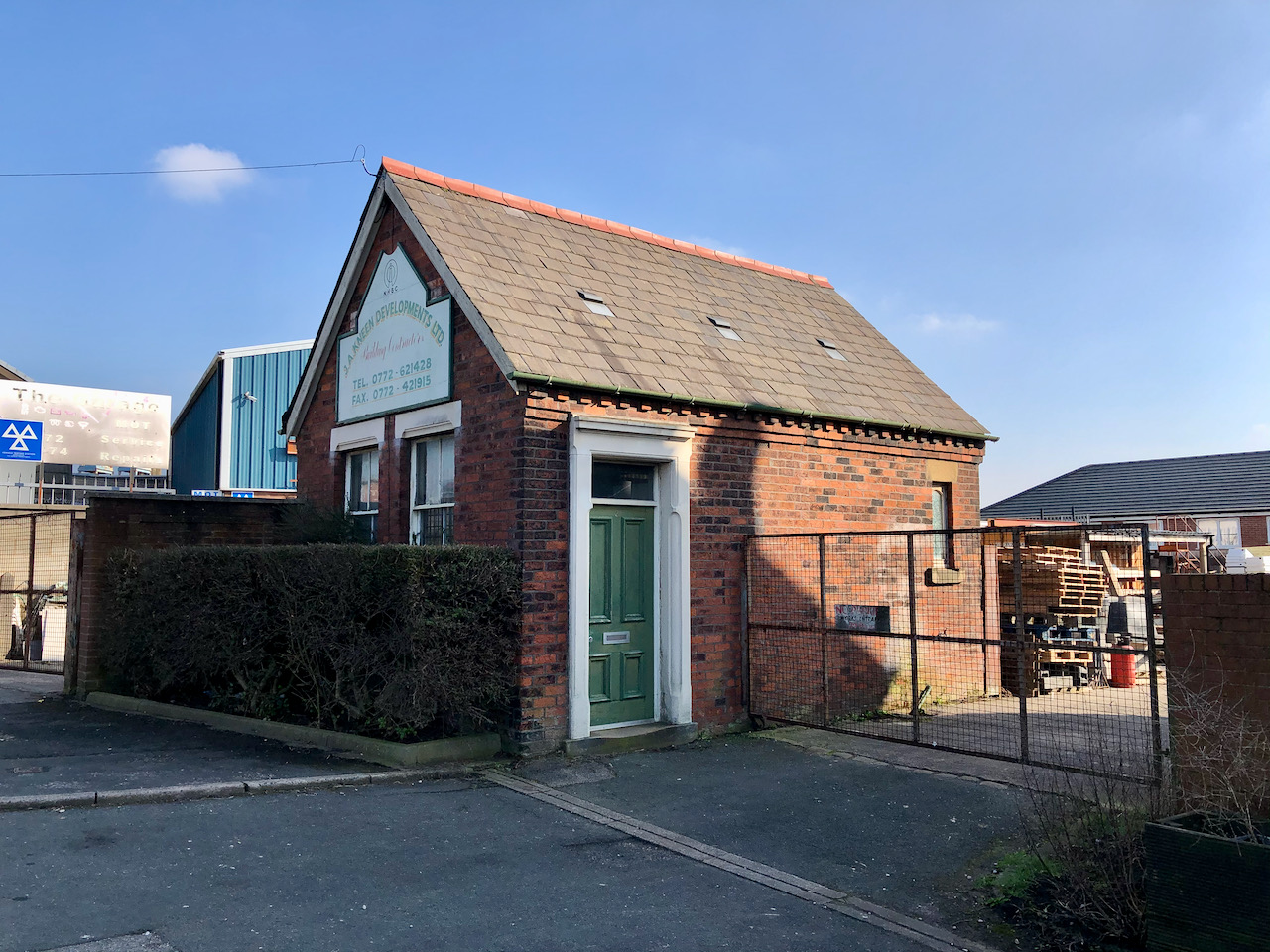
Coal Merchant’s Yard
This building has been used for many years as an office for local coal merchants. The 1848 1:10,560 Ordnance Survey map shows a coal yard in approximately this location, with a small number of associated buildings. The 1894 1:2,500 Ordnance Survey map shows this building and a small number of weighing machines outside.
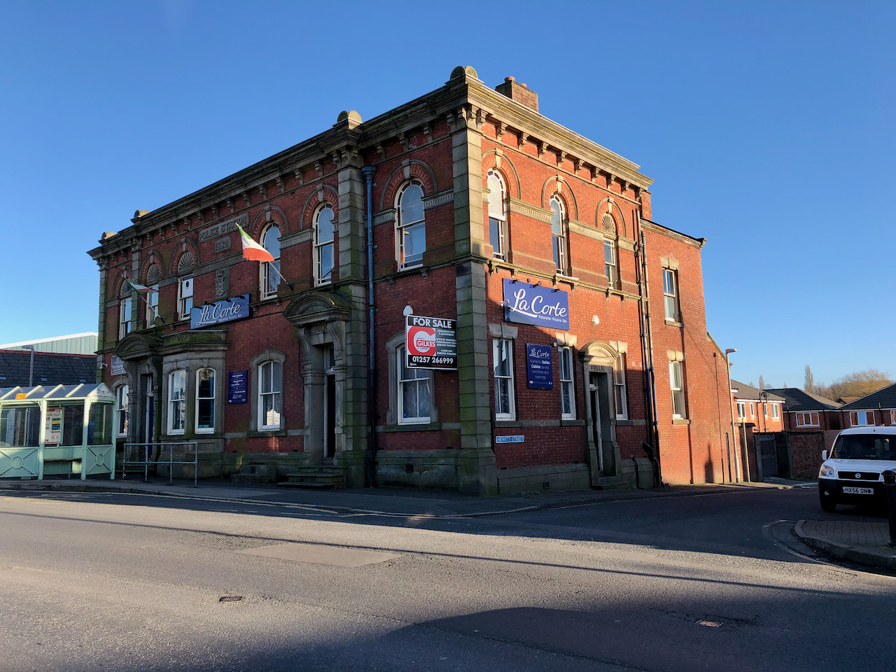
The Former Police Station
The former and very impressive Police Station at the east end of Golden Hill Lane was built in 1882 to replace the Police Station that was on Towngate. It was significantly larger than the older building and had room for cells and a courthouse on the first floor. The building has recently been used as a police-station-themed Italian restaurant, but is currently vacant and is for sale. There is planning permission for nine elegant apartments.
The former Police Station on Golden Hill Lane.
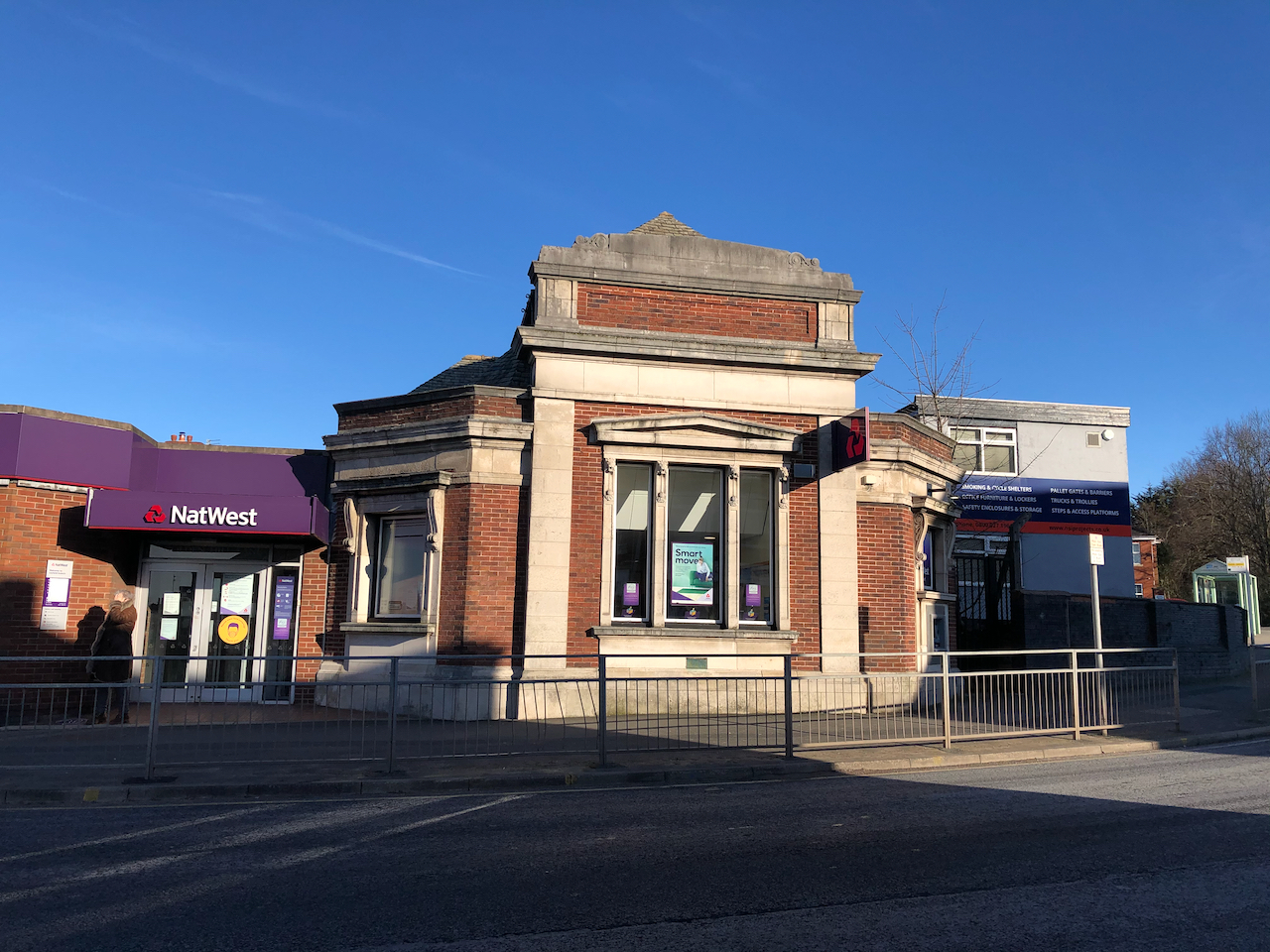
The NatWest Bank
The modern NatWest bank stands on the site of the former Wesleyan Chapel that gave Chapel Brow its name. This ‘modern’ building dates to 1927, although the lower section built on the plot west of the bank was constructed in 1974.
The modern NatWest bank stands on the site of a former Wesleyan Chapel.
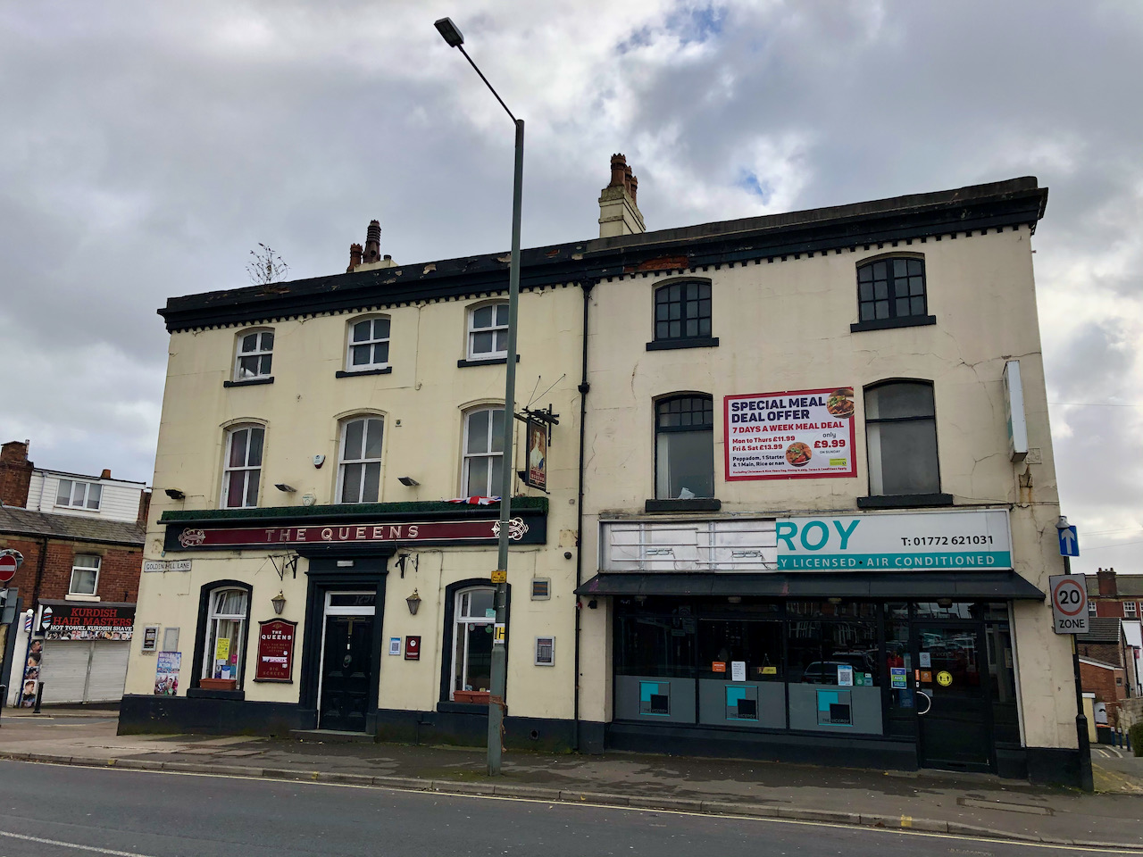
The Queens & The Viceroy
Built as one building around the mid 1850s, the building to the left has always been a public house. The building on the right, now The Viceroy, was originally The Leyland & Farington Co – op shop on Golden Hill Lane. A loading hoist can still be seen on the west side of the building in the small alley running towards Grundy Street. There are two iron support beams. The top beam has the words “Leyland & Farington” embossed into the ironwork. The lower beam, now covered by a shutter, is embossed “Co-operative Society”.
Although a very short road, Chapel Brow is full of history with the land behind the buildings on the west side being the former location of the Leyland Gas Works. Our walk starts at the southwest end of Chapel Brow, once known as gasworks corner, heading northeast to the junction with Golden Hill Lane, Golden Hill, and Station Brow and the NatWest bank.
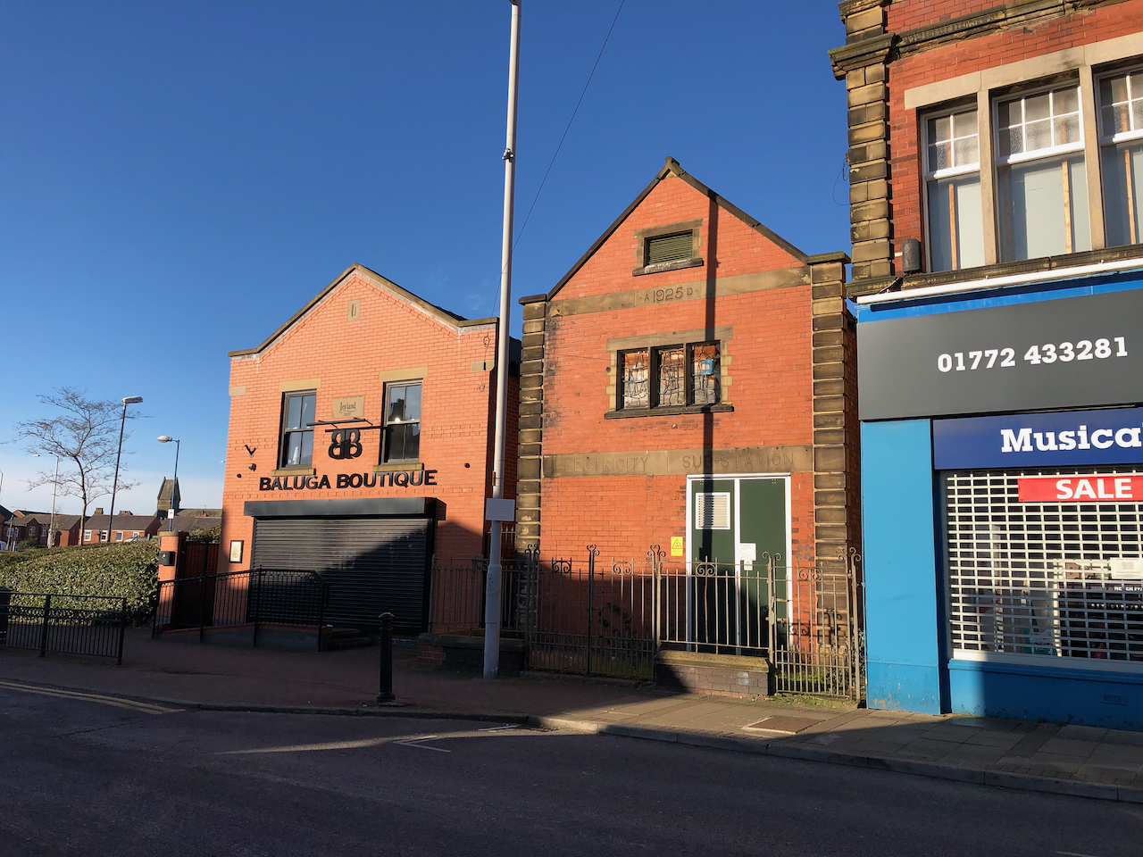
The Lancashire Electric Power Company Sub-station.
The Electricity sub-station was built in 1925 by the Lancashire Electric Power Company (LEP). The LEP was formed under the provisions of the Lancashire Electric Power act of 1900 and supplied local towns with electricity until the late 1940s. The building next door, very much in keeping, was erected in 2011.
The Electricity sub-station was built in 1925 by the Lancashire Electric Power Company (LEP). The LEP was formed under the provisions of the Lancashire Electric Power act of 1900 and supplied local towns with electricity until the late 1940s. The building next door, very much in keeping, was erected in 2011.
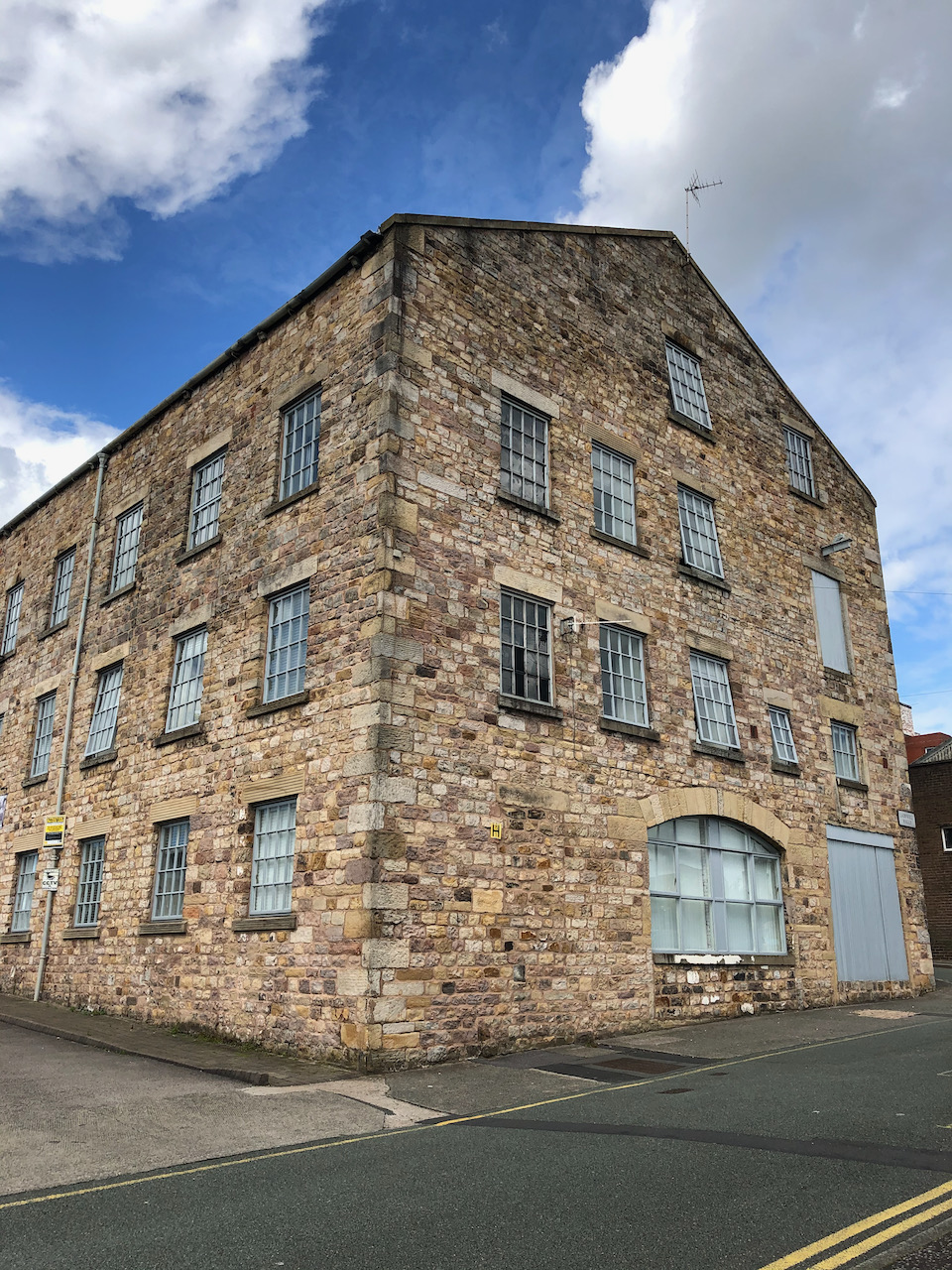
The Leyland and Farrington Co-op building.
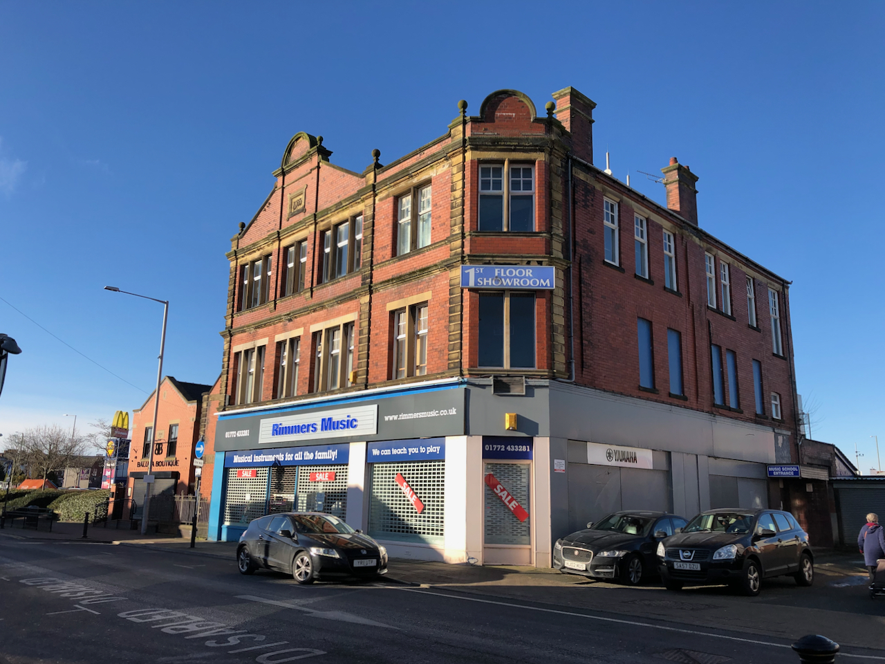
As can be seen easily from the date stone above the east windows, this very splendid brick-built building was erected in 1903. It was used as both a Co-op shop and as the head office for the Leyland and Farrington Co-op. Today, it is well known by many as Rimmers Music store and their music school.
As can be seen easily from the date stone, this splendid brick-built building was erected in 1903 and served as both a Co-op shop and as head office. Today, it is well known as Rimmers Music store and music school.
The NatWest Bank
The NatWest bank more strictly stands on the north side of Golden Hill Lane opposite the junction with Chapel Brow. However, I include it here as it is the site of the former Wesleyan Chapel from which Chapel Brow is named. The red brick with white stone section of the building dates to 1927 while to lower ‘extension’ which includes the main door, was built in 1974.
The modern NatWest bank stands on the site of the eponymous Wesleyan Chapel. This ‘modern’ building dates to 1927, although the lower section built on the plot west of the bank was constructed in 1974.