
the birth of Major General William Roy.
Between 1791 and 1853 the Board of Ordnance carried out a precision survey of Great Britain and Ireland (known as the Principal Triangulation) to establish and fix the precise location of nearly 300 major British landmarks. From the mesh of triangles they measured, highly accurate maps of Great Britain could be made. This was the continuation of work started six years earlier by Major General William Roy (1726 – 1790).
Under the instructions of King George III, Roy had supervised the measurement of a baseline on Hounslow Heath during 1784. This baseline was used to layout a series of triangles, a mesh, to accurately position key locations. The work was done to confirm the accurate positions of the Greenwich and Paris observatories to answer criticism from the French, that the current positions were not accurate. The baseline measured by Roy’s men, in appalling weather conditions, was 27,404.01 feet. The ends of this baseline, terminals, were marked by wooden stakes sunk into the ground. Roy used a 100 feet steel chain for preliminary measurements and then used glass rods (his initial plan was to use wooden rods, but they warped and changed length in the damp conditions) for the final measurements. However, Roy discovered during the measurement that the steel chains were no less accurate than the glass rods and the process was completed using the chain.
For the Principal Triangulation, the baseline was re measured in 1791 by Captain William Mudge (1762 – 1820). Like General Roy, Mudge made use of steel chains and carried out a series of corrections to the measurements to allow for such things as temperature variation (expansion or contraction of the chains), gravity (altering the vertical drop on plumb lines).
These two significant activities are considered by many to mark the beginning of the Ordnance Survey and it is from the work carried out during the Principal Triangulation that the first highly accurate maps of Great Britain and Ireland were made.
For the Principal Triangulation, Mudge re measured Roy’s baseline at 27,404.24 feet. A difference of 0.23 feet (less than 3 inches) from Roy’s measurement made seven years earlier. Between to two measurements this represents an accuracy of 3 parts per million. Mudge replaced the wooden terminal markers with brass cannon as the original posts were found to be in very poor condition.
In 1858 the Ordnance Survey determined that the baseline was 27,406.19 feet. There are a few possible explanations for the difference, one being that because the earth is a sphere so triangles of more than 180 degrees can exist. However, I feel that an error of less than 2 feet (0.01%) in a measurement of over 5 miles is impressive.
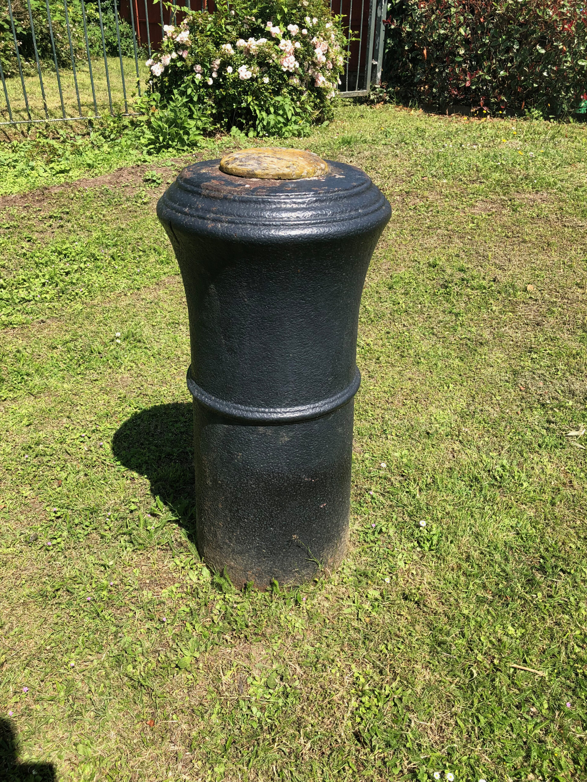
The south-east canon is still in the original location and can be easily seen by anyone interested in visiting. It stands close to 9 Roy Grove, Hampton TW12 3DN. A tablet was erected beside the cannon in 1926 to commemorate 200 years since General Roy’s birth. The north-west marker has been moved, due to Heathrow Airport expansion, and now stands in a small garden area next to the police station at the entrance to Heathrow Airport.
Coming next … Now does triangulation work?