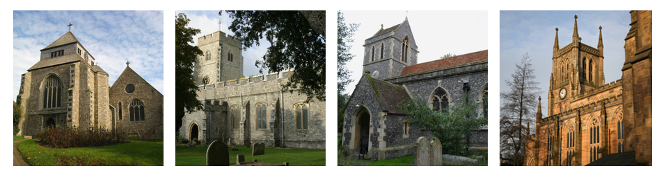
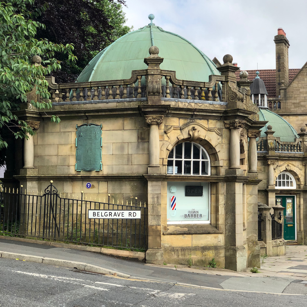
Very little evidence remains of the steam trams that operated in Darwen in the late 1890s and early 1900s. So far, I have only been able to locate the two waiting rooms, one for the ladies and one for the gentlemen, adjacent to each other on Belgrade Square near The Circus and the original turning triangle (steam trams could only run in one direction) to the south along Bolton Road.
Based on size and an external staircase shown on early maps beside the north building, my suspicion is that the southern waiting room (first picture below and adjacent to Belgrave Road) is the Ladies’ waiting room.
Borough of Darwen / Tramways / Department / Erected 1902 / The Local Board leased the square from James Greenway for 999 years from 2nd December 1867. It became the boarding point for the steam tramway which commenced in 1881; this was then the widest part of the road in the town centre to take double not single track. The Tramway Company was requested to build waiting rooms, and did in fact produce plans. When the Corporation took over they built waiting rooms and underground toilets, designed by the Borough Engineer, R.W. Smith-Saville, which opened in January 1903. The ladies’ waiting room had an internal entrance to the toilets, whilst the gentlemen had an external entrance. At the rear of the gentlemen’s waiting room was a parcels’ office for the tramway. The office closed in 1939, the toilets in 1988.The Local Board leased the square from James Greenway for 999 years from 2nd December 1867. It became the boarding point for the steam tramway which commenced in 1881; this was then the widest part of the road in the town centre to take double not single track. The Tramway Company was requested to build waiting rooms, and did in fact produce plans. When the Corporation took over they built waiting rooms and underground toilets, designed by the Borough Engineer, R.W. Smith-Saville, which opened in January 1903. The ladies’ waiting room had an internal entrance to the toilets, whilst the gentlemen had an external entrance. At the rear of the gentlemen’s waiting room was a parcels’ office for the tramway. The office closed in 1939, the toilets in 1988.This was in use from 5th December 1881 until 30th November 1900. It marked the southern end of the first steam-powered tramway authorised to run along a public highway. The line from Darwen Circus to St. Peter Street, Blackburn opened on 14th April 1881, and was later extended to this terminus. It was declared an ancient monument in 1977.
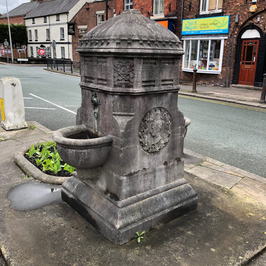
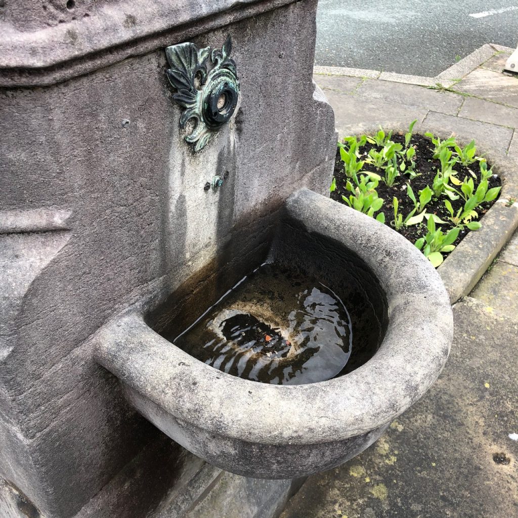
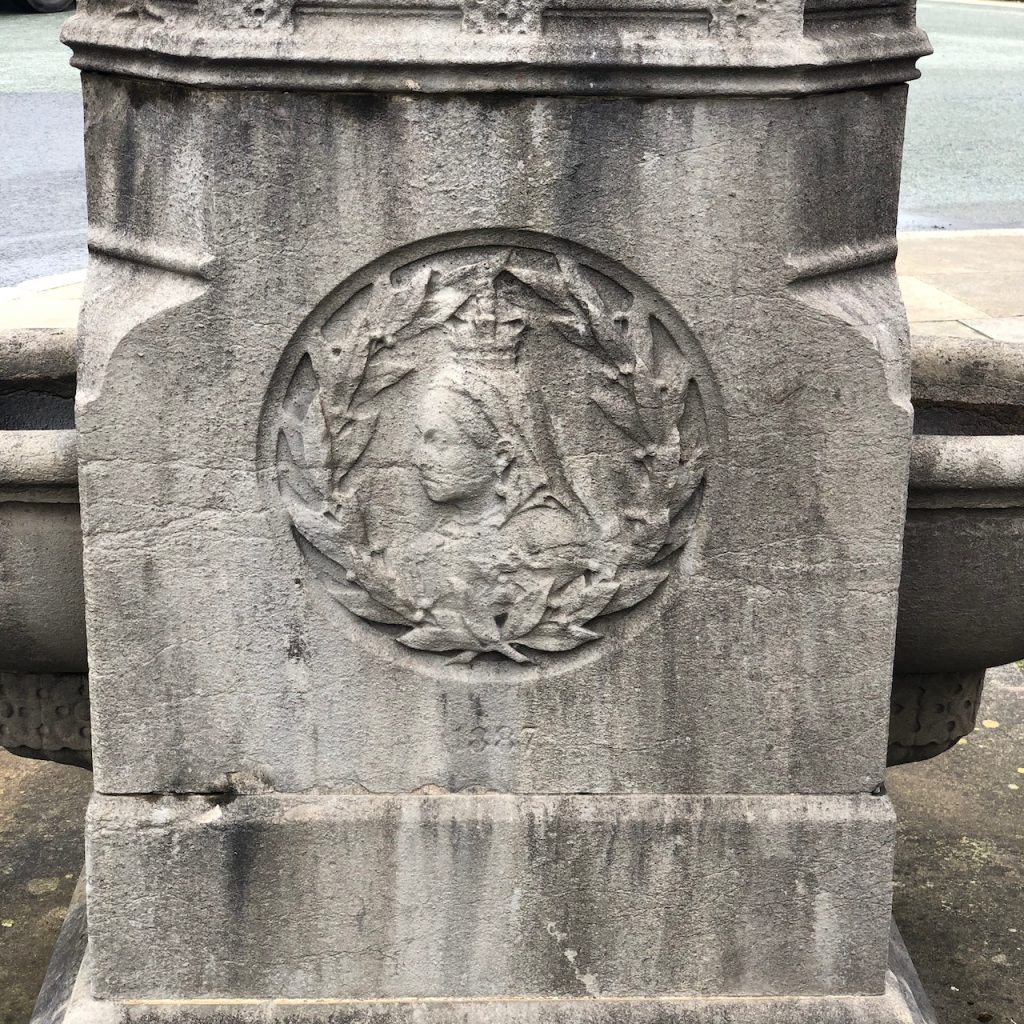
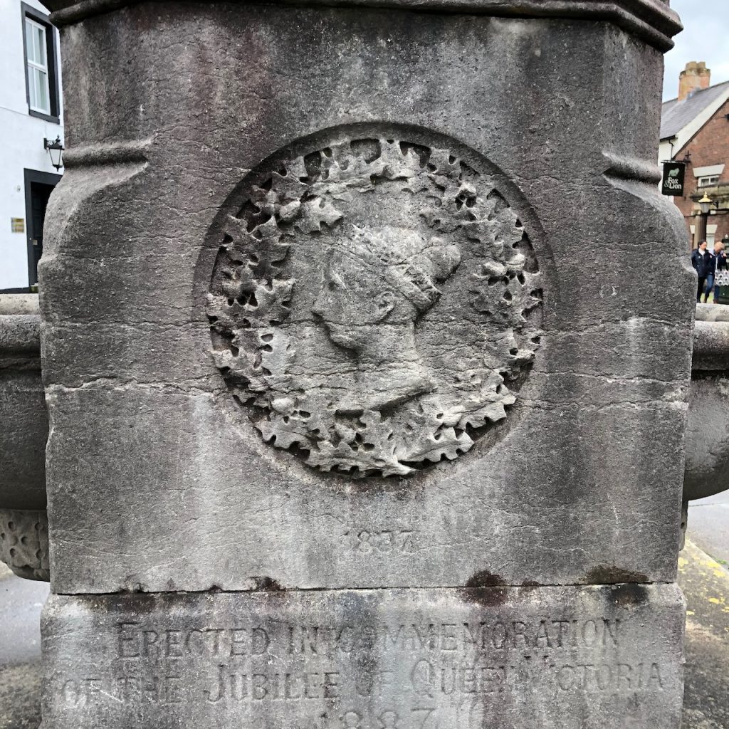
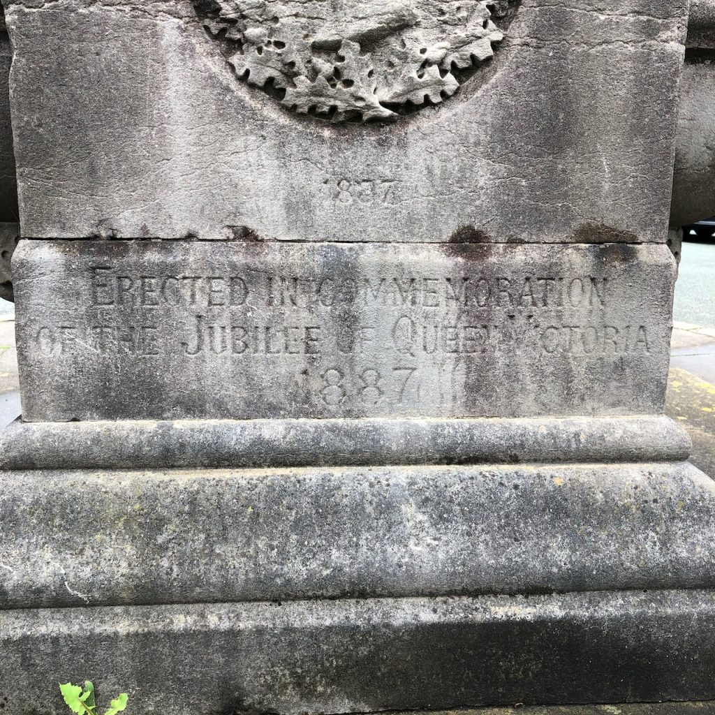
Standing adjacent to the well-known Leyland Cross at the west end of Church Road, is the drinking fountain. It was erected in 1887 in commemoration of the jubilee of Queen Victoria.
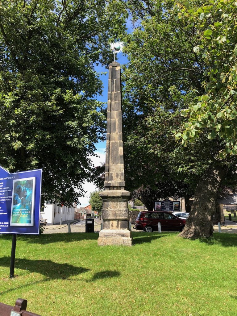
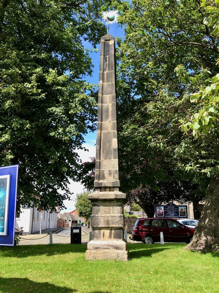
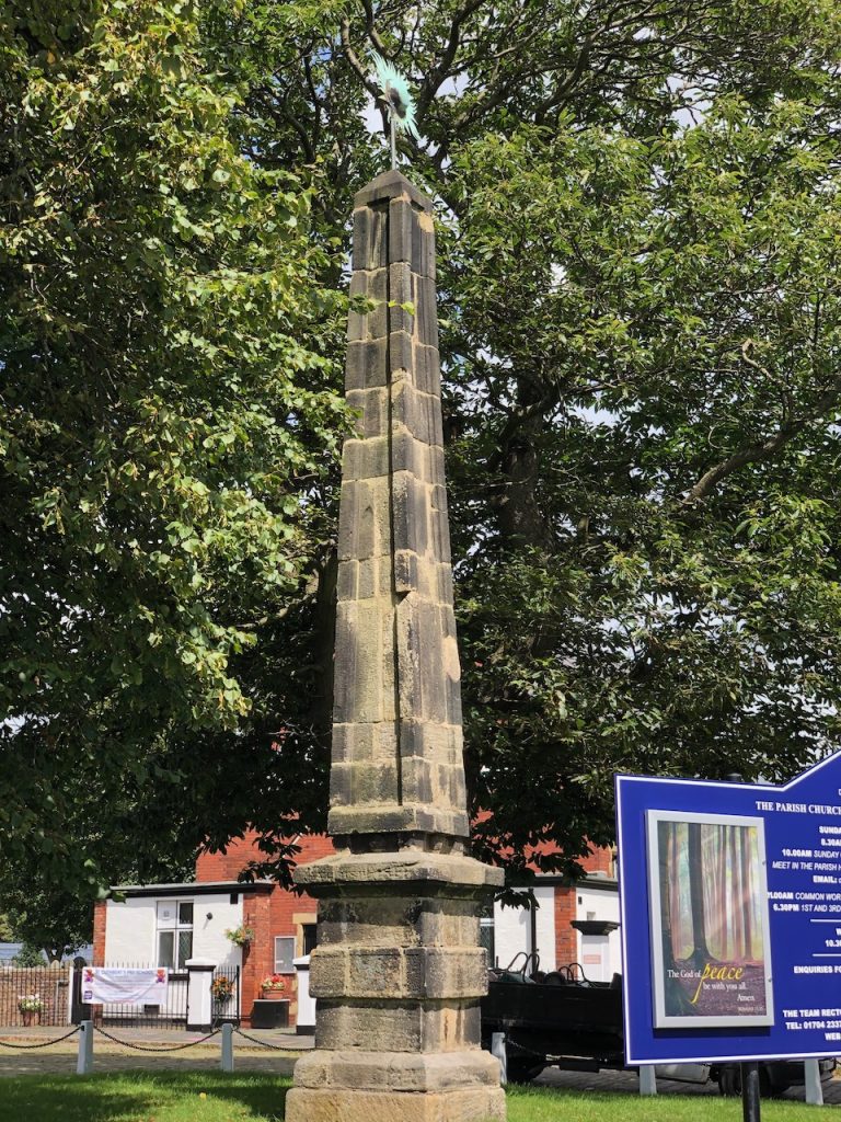
Now situated at Churchtown, Southport, Mersyside this 18 century commemorative obelisk was formerly at Worden Hall, Leyland. Following the fire at Worden Hall the obelisk was sold around 1948 to Colonel Roger Fleetwood Hesketh of Meols Hall and placed here in 1950. It is made from dressed gritstone blocks, of square section. The pedestal is c. 2m high, with a chamfered base, one broad band and a cavetto-moulded cornice with a worn inscription running round the east, north and west sides: Rebuilt in Commemoration of the Glorious illegible.
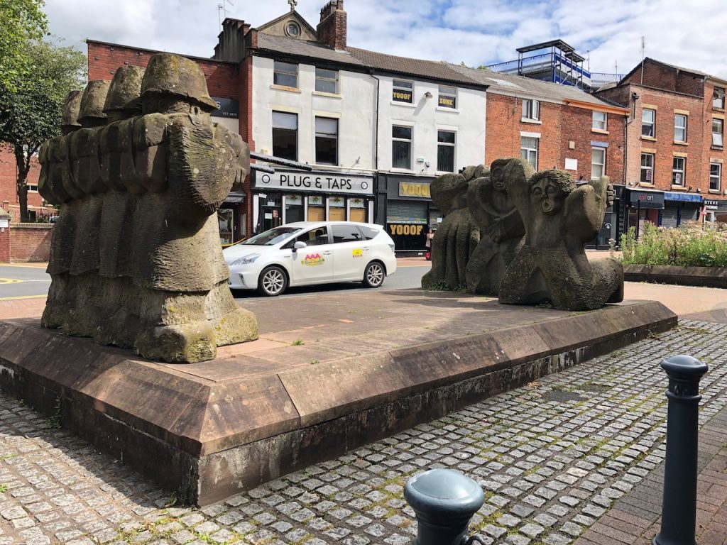
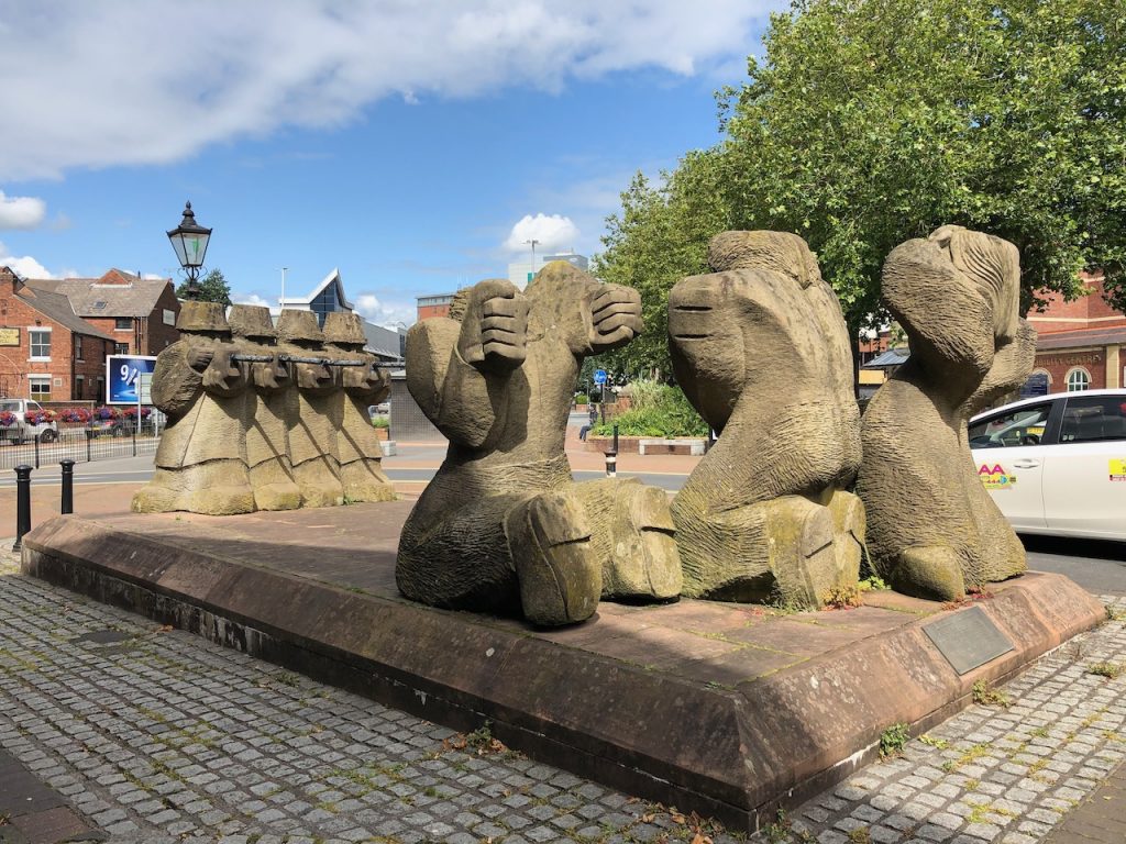
At the north end of Lune Street just south of the modern ring road is this striking memorial. It is dedicated by the trades union of Preston to the memory of all workers worldwide who are killed, injured, suffer ill health or detriment as a consequence of work. Remember the dead, fight for the living.
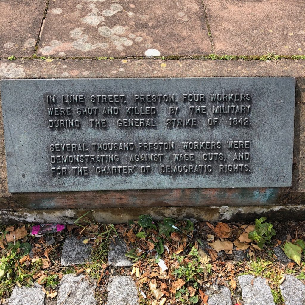
In Lune Street, Preston, four workers were shot and killed by the military during the general strike of 1842. Several thousand Preston workers were demonstrating against wage cuts , and for the ‘charter’ of democratic rights.
Bronze tablet on memorial.
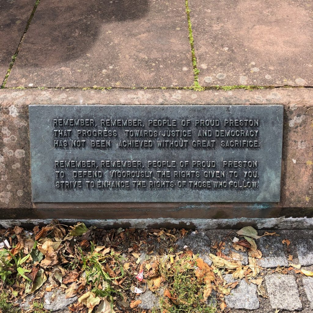
Remember, Remember, People of proud Preston that progress towards justice and democracy had not been achieved without great sacrifice.
Remember, Remember, People of proud Preston defend vigorously the rights given to you. Strive to enhance the rights of those who follow.
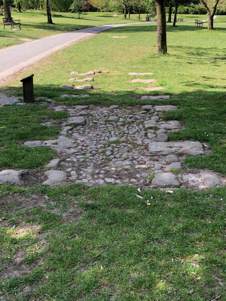
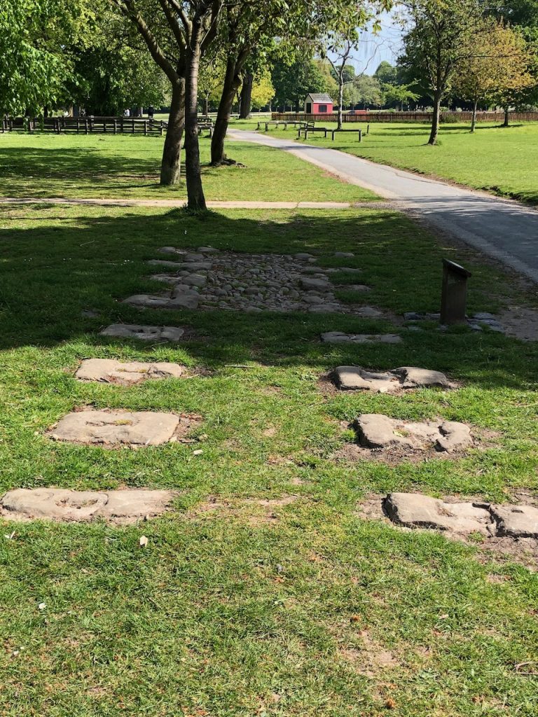
This short section of the track bed from the Preston & Walton Summit Tramway was moved from Bamber Bridge and relayed in Worden Park by the Chorley historic society.
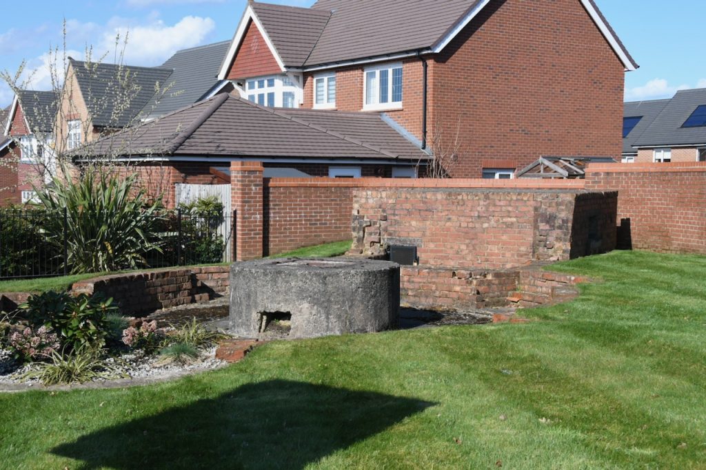
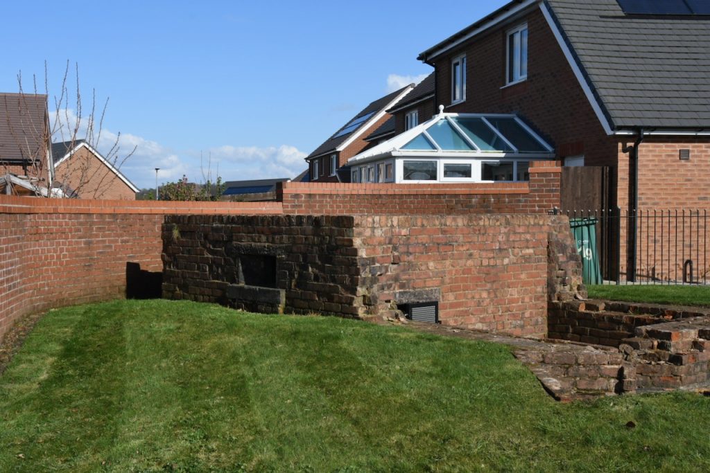
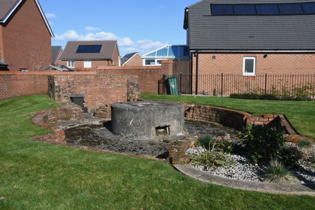
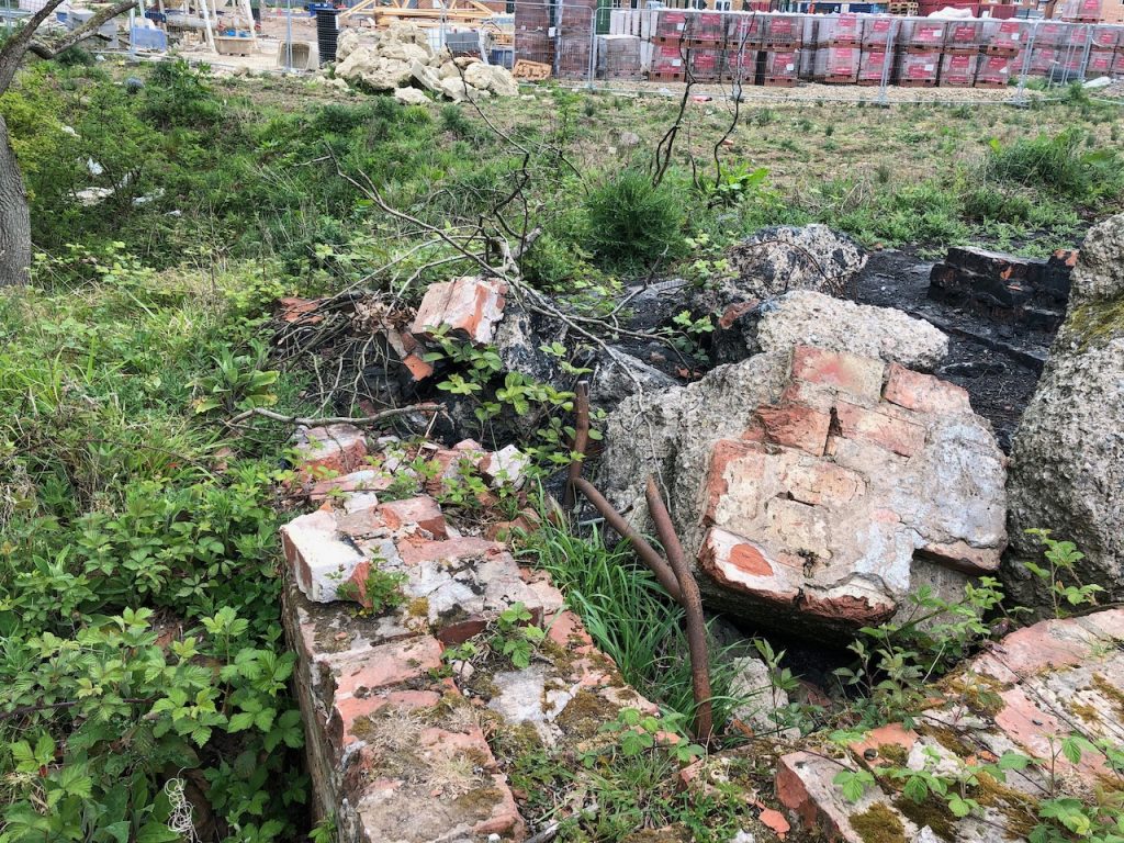
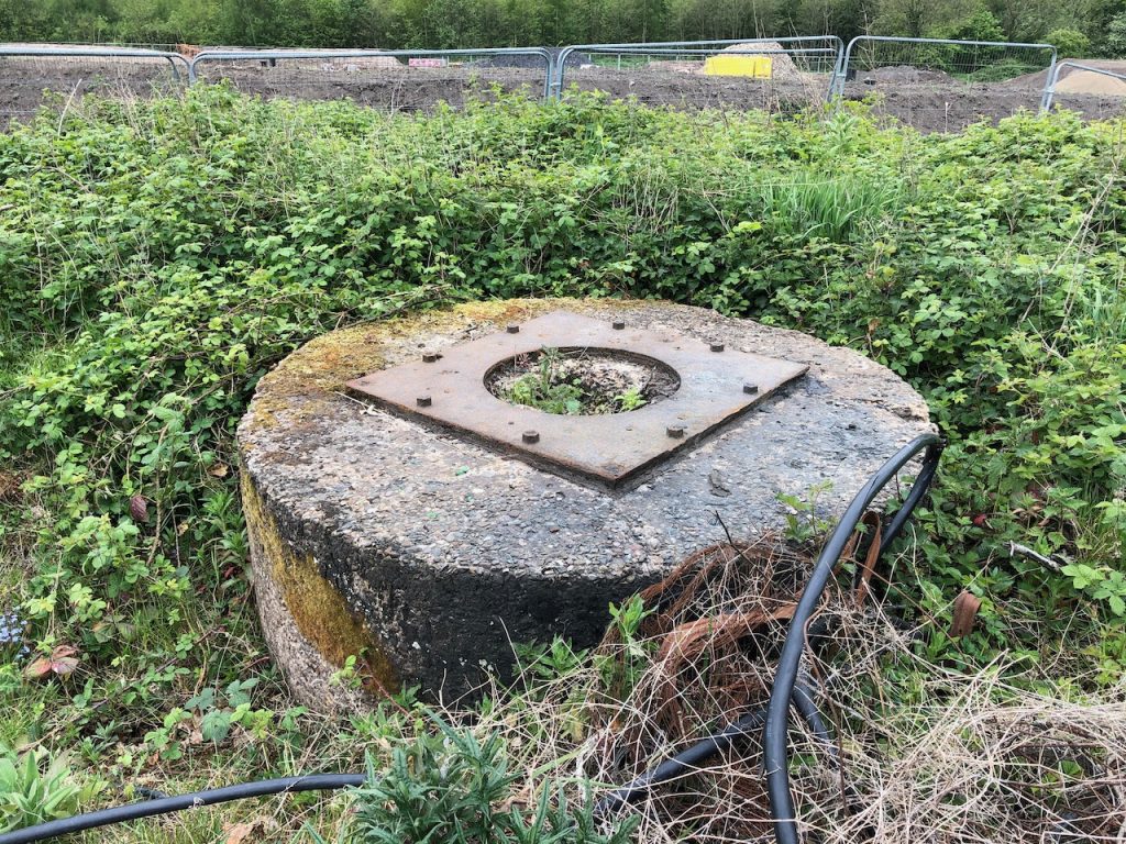
There were originally over 1,200 such anti-aircraft gun sites built during World War 2, with only about eighty now surviving. This site was rediscovered in 2013 during investigations carried out for Redrow Homes prior to starting house building on the site.
It comprises a light anti-aircraft gun emplacement, a static Bofors 40mm gun, with an attached pillbox. It was built to defend the nearby Royal Ordnance Factory on Euxton Lane.
The site has been preserved and can be accessed via the modern housing estate.
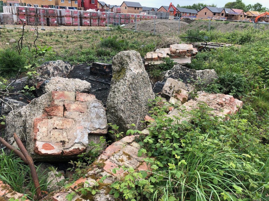
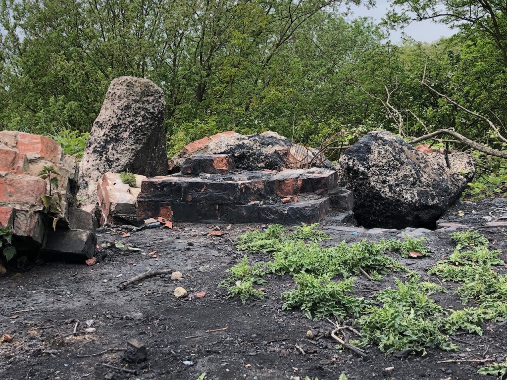
I’ve been told there are a few anti-aircraft installations around Hall Lane, Wheelton Lane, and Centurian Way. They were built during World War 2 to protect the various factories in the area. This one is in the fields at the bottom of Hall Lane.
A ruined anti-aircraft installation in the fields at the north east end of Hall Lane.A ruined anti-aircraft installation in the fields at the north east end of Hall Lane.A ruined anti-aircraft installation in the fields at the north east end of Hall Lane.A ruined anti-aircraft installation in the fields at the north east end of Hall Lane.
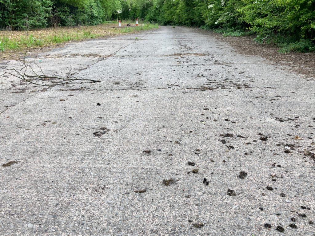
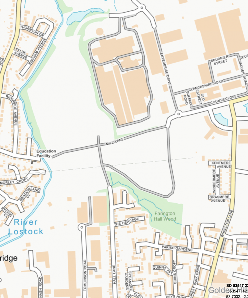
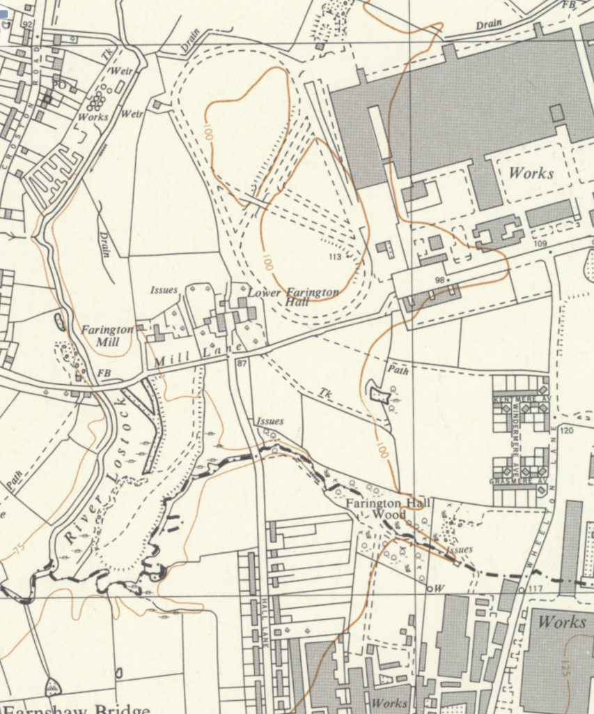
Little evidence remains of the Ministry of Supply tank factory in Leyland. However, following a tipoff and while reviewing information about Lower Farington Hall we discovered that part of the test track surface can still be seen today.
Located at the north end of Hall Lane, most of the original track has been lost to the development of industrial units, but the road structure still follows the route of the original track. At the north west end, the original track surface can be seen behind large gates.
The location of the test track can be seen clearly in the two images below.
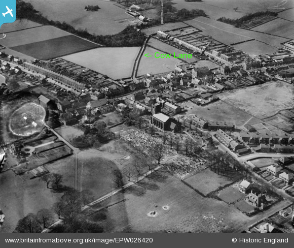
As far as I can tell, Cow Lane existed until development work on the Broadfield estate wiped it out during the early 1970s. Having said that, there are still signs that it existed if you know where to look. This is a series of photographs I have taken showing some of those signs.
Clearly shown and named on the 1841 O/S First Issue map, Cow Lane runs from east to west starting at the southern end of Towngate down to Stanning’s Bleach Works at Shrugs. The aerial photograph shows Cow Lane starting from its junction with Towngate, heading across fields and bending around land at the bottom of Spring Gardens.
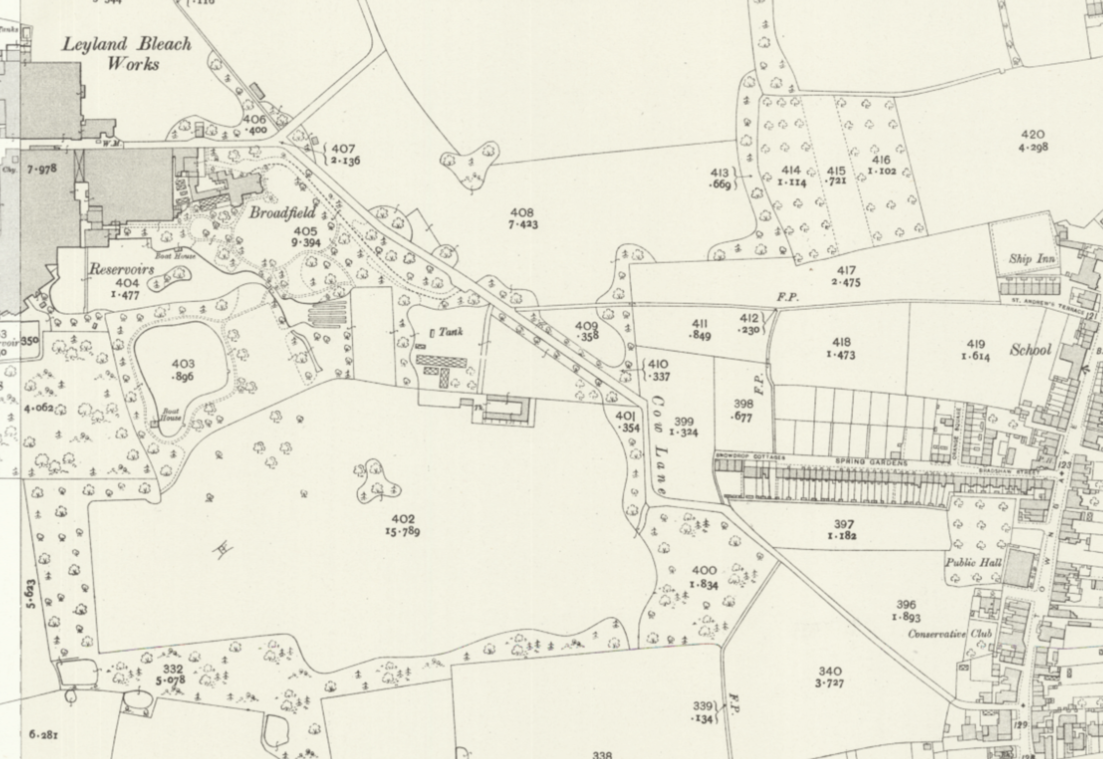
Cow Lane shown on the 25″ OS Map of Leyland.
Towngate
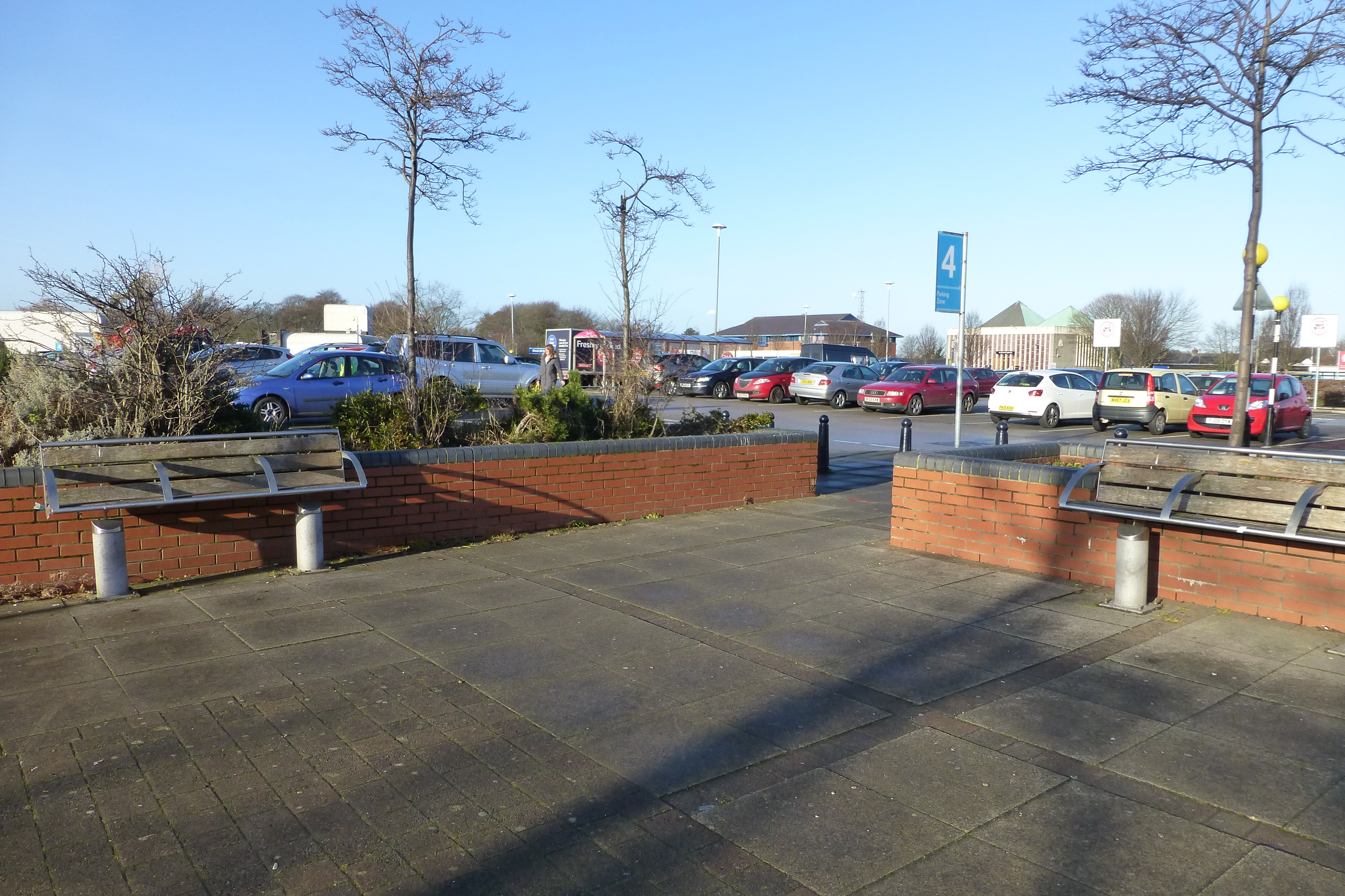
The southern end of Towngate no longer exists and has become a car park outside of the modern Tesco’s superstore. The original line of Towngate can still be seen in the various pedestrian crossings and gaps in the wall. The junction with Cow Lane is now replaced by a number of planters.
The Junction of Towngate and Cow Lane.
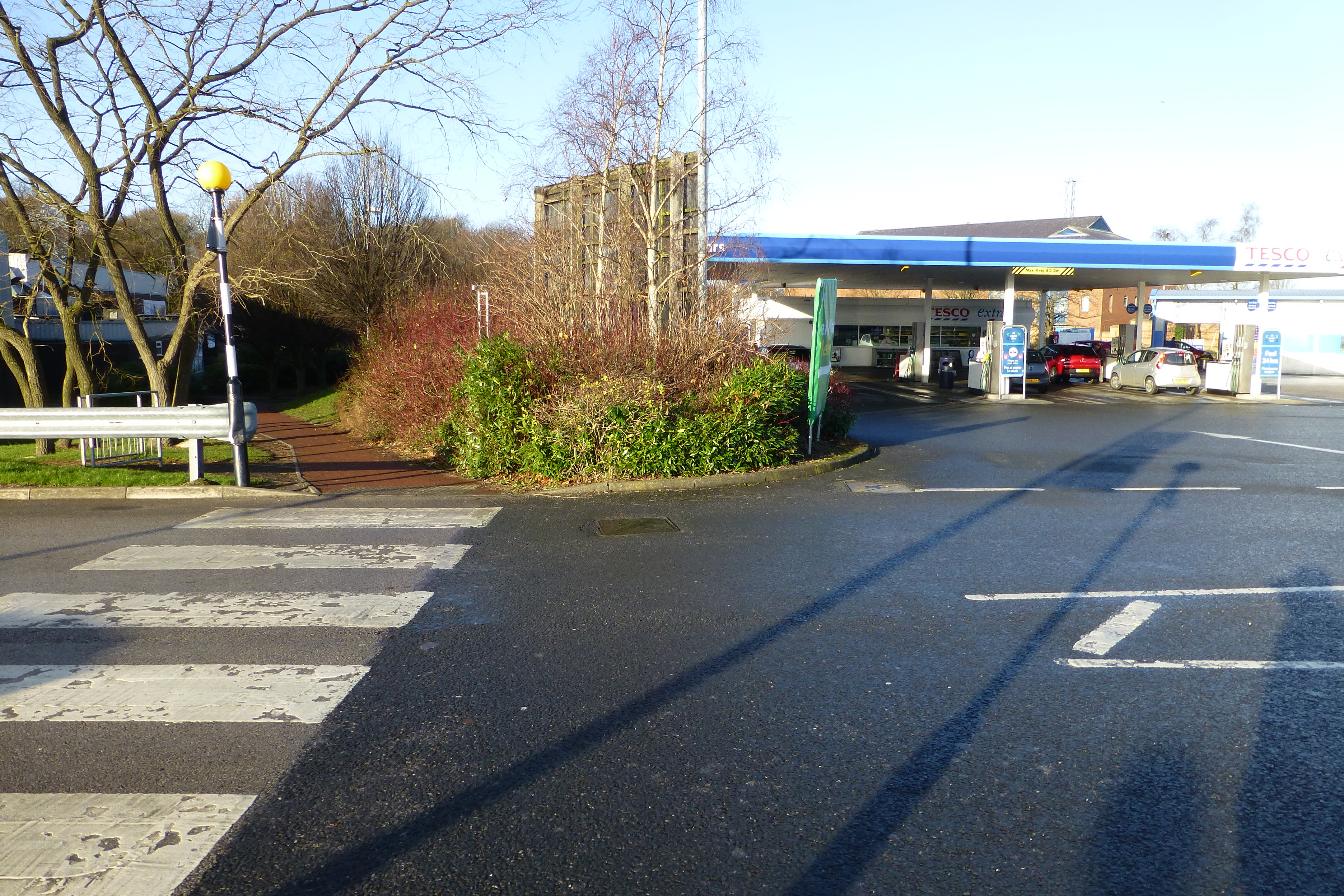
The line of Cow Lane heads due west from here for a short distance before turning to the north-west and heading down to the petrol filling station and Leyland Leisure Centre. A pedestrian crossing marks the original line of Cow Lane.
The Line of Cow Lane.
This pedestrian crossing marks the original line of Cow Lane. From here it ran in a north-west direction and passed to the south side of Tesco’s Petrol Station before crossing the modern Lancastergate and then passing through the modern Lee Rigby building. As Cow Lane reached the grassy area at the with trees at the junction of Lancastergate and Broadfield Drive it turned and headed almost due west crossing Broadfield Drive where it turned at a right angle and headed due north along what is now called Broadfield Walk.
Broadfield Walk
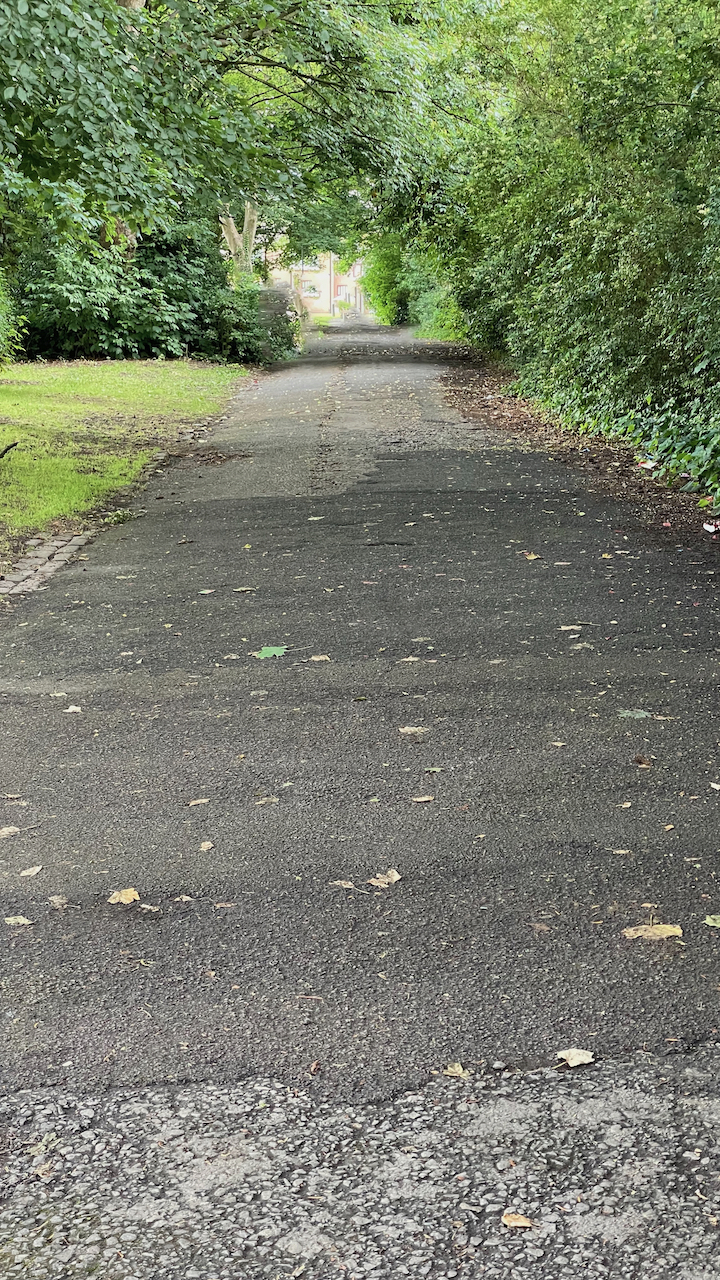
The path beside Broadfield Drive follows the line of Cow Lane.The path beside Broadfield Drive follows the line of Cow Lane.
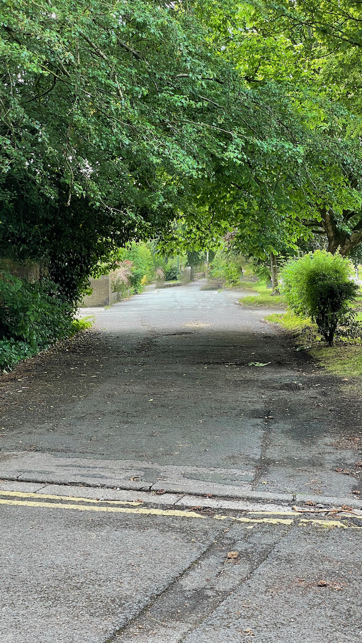
As Cow Lane headed north there was a stone wall separating the road from Shruggs. A small portion of this will can still be seen along Broadfield Walk between Nursery Close and the back entrance to the Catholic Church.
Part of the wall on the western side of Cow Lane.
Elmwood Avenue
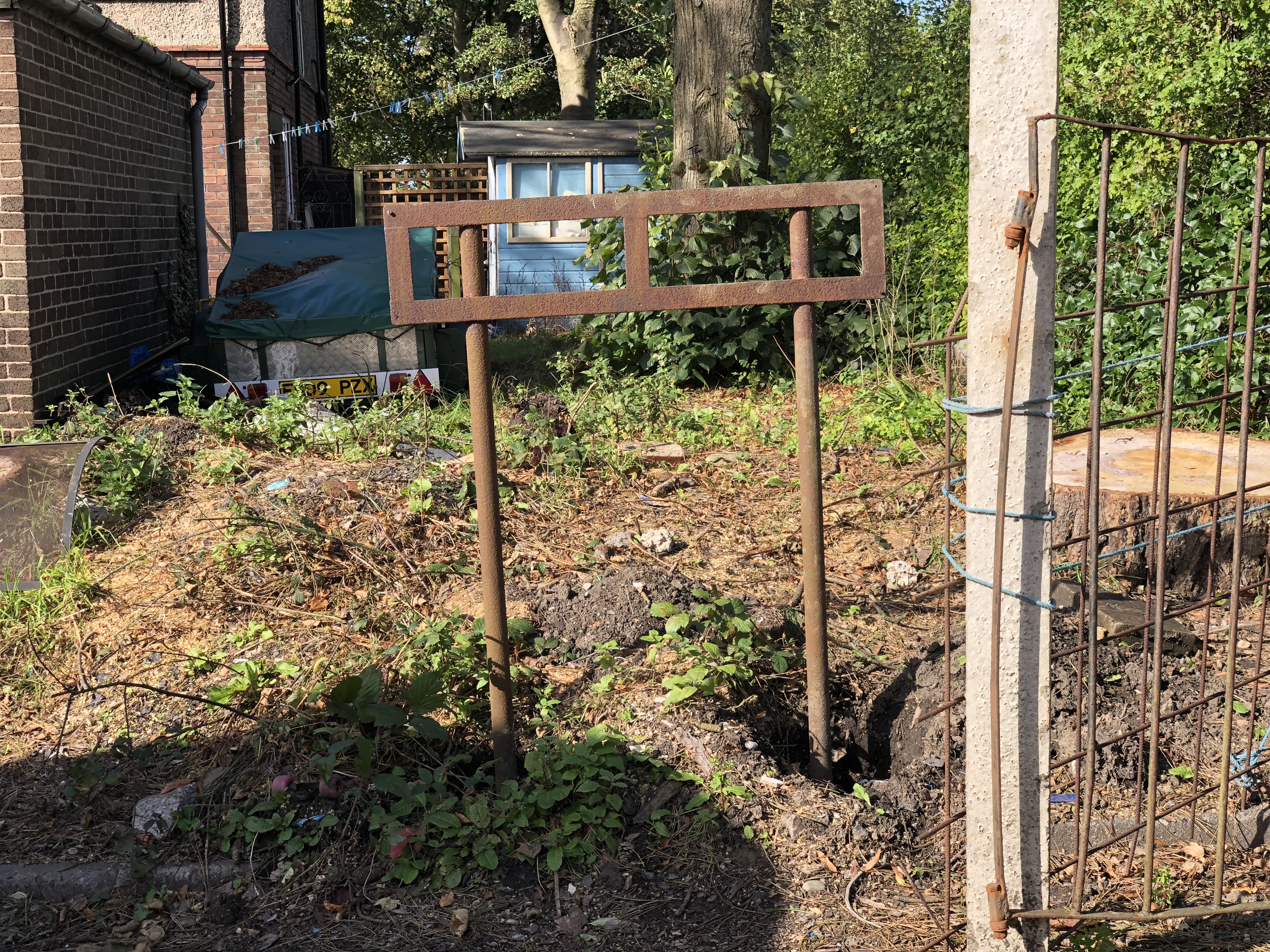
Just before turning into Elmwood Avenue from Broadfield Drive, the frame of a street sign stands next to the stone sets in the garden of a private house.
A street sign from Cow Lane.
There a strong signs of Cow Lane in Elmwood Avenue. Two of the houses, at the junction with Broadfield Drive, still have kerb stones and stone sets in place. I can also remember seeing part of a street sign frame where Cow Lane turns off to the north along Broadfield Drive.
Remnants of Cow Lane can be seen in the gardens of two houses in Elmwood Avenue.